Area Overview for ST4 3LA
Photos of ST4 3LA


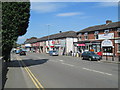

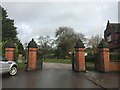
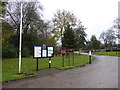

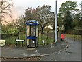


46 photos from this area
Area Information
Key information about the ST4 3LA including its size, population, and administrative classification.
- Area Type
- Postcode
- Area Size
- 6675 m²
- Population
- 1772
- Population Density
- 2160 people/km²
House Prices in ST4 3LA
24
Properties
£79,270
Average Sold Price
£28,000
Lowest Price
£112,000
Highest Price
Showing 24 properties
| Address | Type | Beds | Baths | Last Sale Price | Last Sale Date | |
|---|---|---|---|---|---|---|
| 36 Cowper Street, Fenton, Stoke On Trent, ST4 3LA | house | 3 | - | £90,000 | Jan 2025 | |
| 38 Cowper Street, Fenton, Stoke On Trent, ST4 3LA | house | - | - | £85,000 | May 2022 | |
| 4 Cowper Street, Fenton, Stoke On Trent, ST4 3LA | Terraced | 2 | 1 | £70,250 | Feb 2019 | |
| 26 Cowper Street, Fenton, Stoke On Trent, ST4 3LA | Semi-detached | 3 | - | £112,000 | Dec 2017 | |
| 24 Cowper Street, Fenton, Stoke On Trent, ST4 3LA | house | - | - | £84,950 | Jul 2016 | |
| 6 Cowper Street, Fenton, Stoke On Trent, ST4 3LA | Terraced | 2 | 1 | £56,000 | Feb 2016 | |
| 34 Cowper Street, Fenton, Stoke On Trent, ST4 3LA | Semi-detached | - | - | £98,593 | Oct 2006 | |
| 15 Cowper Street, Fenton, Stoke On Trent, ST4 3LA | Semi-detached | - | - | £95,000 | Mar 2005 | |
| 28 Cowper Street, Fenton, Stoke On Trent, ST4 3LA | house | - | - | £102,500 | Dec 2004 | |
| 7 Cowper Street, Fenton, Stoke On Trent, ST4 3LA | Semi-detached | 3 | 1 | £69,950 | Apr 2004 |
Page 1 of 3
Energy Efficiency in ST4 3LA
Amenities
Schools
| Rank | School | Type | Entry gender | Ages |
|---|
Explore more schools in this area
Go to Schools tabDemographics
Household Size
One person
most common
Accommodation Type
Houses
most common
Tenure
47
majority
Ethnic Group
White
most common
Religion
N/A
most common
Household Composition
N/A
most common
Age
47
median
Adults (30-64 years)
most common
Household Deprivation
N/A
with no deprivation
NS-SEC
16
in Lower managerial occupations
Explore more demographic insights in this area
Go to Demographics tabPlanning
Planning Constraints
- Flood RiskPremium
- Ramsar Wetland SitesPremium
- Area of Outstanding Natural BeautyPremium
- Protected Nature ReservePremium
- Protected WoodlandPremium