Area Overview for ST4 2BP
Photos of ST4 2BP


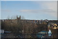
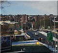
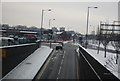
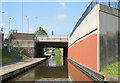


99 photos from this area
Area Information
Key information about the ST4 2BP including its size, population, and administrative classification.
- Area Type
- Postcode
- Area Size
- 3343 m²
- Population
- 1366
- Population Density
- 10240 people/km²
House Prices in ST4 2BP
22
Properties
£82,828
Average Sold Price
£25,000
Lowest Price
£130,000
Highest Price
Showing 22 properties
| Address | Type | Beds | Baths | Last Sale Price | Last Sale Date | |
|---|---|---|---|---|---|---|
| 209 Leek Road, Stoke On Trent, ST4 2BP | house | - | - | £130,000 | May 2025 | |
| 197 Leek Road, Stoke On Trent, ST4 2BP | Terraced | 3 | 1 | £130,000 | Apr 2024 | |
| 211 Leek Road, Stoke On Trent, ST4 2BP | Terraced | 4 | 2 | £70,000 | Nov 2021 | |
| 221 Leek Road, Stoke On Trent, ST4 2BP | house | 3 | - | £120,000 | Nov 2019 | |
| 225 Leek Road, Stoke On Trent, ST4 2BP | Terraced | 4 | 1 | £84,000 | Nov 2017 | |
| 203 Leek Road, Stoke On Trent, ST4 2BP | Terraced | 3 | 1 | £106,000 | Sep 2017 | |
| 201 Leek Road, Stoke On Trent, ST4 2BP | Terraced | 4 | 1 | £78,000 | Jun 2017 | |
| 223 Leek Road, Stoke On Trent, ST4 2BP | Terraced | 3 | 1 | £99,000 | Mar 2015 | |
| 235 Leek Road, Stoke On Trent, ST4 2BP | house | - | - | £67,000 | Nov 2014 | |
| 231 Leek Road, Stoke On Trent, ST4 2BP | Terraced | 4 | 1 | £87,000 | Feb 2014 |
Page 1 of 3
Energy Efficiency in ST4 2BP
Amenities
Schools
| Rank | School | Type | Entry gender | Ages |
|---|
Explore more schools in this area
Go to Schools tabDemographics
Household Size
Family (3-5 people)
most common
Accommodation Type
Houses
most common
Tenure
17
majority
Ethnic Group
White
most common
Religion
N/A
most common
Household Composition
N/A
most common
Age
22
median
Young Adults (15-29 years)
most common
Household Deprivation
N/A
with no deprivation
NS-SEC
5
in Lower managerial occupations
Explore more demographic insights in this area
Go to Demographics tabPlanning
Planning Constraints
- Flood RiskPremium
- Ramsar Wetland SitesPremium
- Area of Outstanding Natural BeautyPremium
- Protected Nature ReservePremium
- Protected WoodlandPremium