Area Overview for ST3 7JB
Photos of ST3 7JB


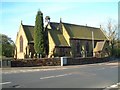
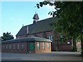
37 photos from this area
Area Information
Key information about the ST3 7JB including its size, population, and administrative classification.
- Area Type
- Postcode
- Area Size
- 1.4 hectares
- Population
- 1723
- Population Density
- 5383 people/km²
House Prices in ST3 7JB
19
Properties
£107,300
Average Sold Price
£30,000
Lowest Price
£185,000
Highest Price
Showing 19 properties
| Address | Type | Beds | Baths | Last Sale Price | Last Sale Date | |
|---|---|---|---|---|---|---|
| 80 Meir Road, Normacot, Stoke On Trent, ST3 7JB | Detached | 3 | 2 | £164,995 | Sep 2025 | |
| 52 Meir Road, Normacot, Stoke On Trent, ST3 7JB | Semi-detached | 2 | 1 | £95,000 | Jun 2024 | |
| 40 Meir Road, Normacot, Stoke On Trent, ST3 7JB | house | - | - | £185,000 | Feb 2023 | |
| 74 Meir Road, Normacot, Stoke On Trent, ST3 7JB | house | - | - | £125,000 | Apr 2019 | |
| 54 Meir Road, Normacot, Stoke On Trent, ST3 7JB | house | - | - | £142,000 | Feb 2017 | |
| 42 Meir Road, Normacot, Stoke On Trent, ST3 7JB | house | - | - | £96,000 | Jun 2014 | |
| Sandyfields, Meir Road, Normacot, Stoke On Trent, ST3 7JB | Bungalow | 2 | 1 | £85,000 | Jul 2013 | |
| 44 Meir Road, Normacot, Stoke On Trent, ST3 7JB | Semi-detached | - | - | £80,000 | Nov 2003 | |
| Hillside Cottage, 82 Meir Road, Normacot, Stoke On Trent, ST3 7JB | house | - | - | £70,000 | Oct 2000 | |
| 48 Meir Road, Normacot, Stoke On Trent, ST3 7JB | Semi-detached | - | - | £30,000 | Mar 1999 |
Page 1 of 2
Energy Efficiency in ST3 7JB
Amenities
Schools
| Rank | School | Type | Entry gender | Ages |
|---|
Explore more schools in this area
Go to Schools tabDemographics
Household Size
Family (3-5 people)
most common
Accommodation Type
Houses
most common
Tenure
58
majority
Ethnic Group
White
most common
Religion
N/A
most common
Household Composition
N/A
most common
Age
47
median
Adults (30-64 years)
most common
Household Deprivation
N/A
with no deprivation
NS-SEC
18
in Lower managerial occupations
Explore more demographic insights in this area
Go to Demographics tabPlanning
Planning Constraints
- Flood RiskPremium
- Ramsar Wetland SitesPremium
- Area of Outstanding Natural BeautyPremium
- Protected Nature ReservePremium
- Protected WoodlandPremium