Area Overview for ST3 7EB
Photos of ST3 7EB

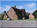

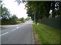


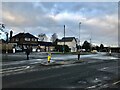
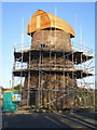
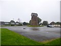

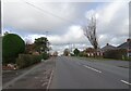
17 photos from this area
Area Information
Key information about the ST3 7EB including its size, population, and administrative classification.
- Area Type
- Postcode
- Area Size
- 1.4 hectares
- Population
- 1446
- Population Density
- 3671 people/km²
House Prices in ST3 7EB
23
Properties
£163,232
Average Sold Price
£40,500
Lowest Price
£295,000
Highest Price
Showing 23 properties
| Address | Type | Beds | Baths | Last Sale Price | Last Sale Date | |
|---|---|---|---|---|---|---|
| 334 Sandon Road, Meir, Stoke On Trent, ST3 7EB | Semi-detached | 3 | 1 | £235,000 | Mar 2025 | |
| 354 Sandon Road, Meir, Stoke On Trent, ST3 7EB | Semi-detached | 3 | 2 | £200,000 | Sep 2024 | |
| 348 Sandon Road, Meir, Stoke On Trent, ST3 7EB | Retail | 3 | 2 | £295,000 | Dec 2022 | |
| 332 Sandon Road, Meir, Stoke On Trent, ST3 7EB | house | 3 | - | £230,000 | Dec 2022 | |
| 324 Sandon Road, Meir, Stoke On Trent, ST3 7EB | Semi-detached | 3 | 1 | £220,000 | Nov 2021 | |
| 328 Sandon Road, Meir, Stoke On Trent, ST3 7EB | Semi-detached | 3 | 2 | £187,500 | Dec 2020 | |
| 330 Sandon Road, Meir, Stoke On Trent, ST3 7EB | Semi-detached | 3 | 1 | £148,000 | Jul 2020 | |
| 350 Sandon Road, Meir, Stoke On Trent, ST3 7EB | house | - | - | £180,000 | Mar 2018 | |
| 364 Sandon Road, Meir Heath, Stoke On Trent, ST3 7EB | house | - | - | £125,000 | Jul 2014 | |
| 336 Sandon Road, Meir, Stoke On Trent, ST3 7EB | Semi-detached | 3 | 1 | £124,950 | Apr 2012 |
Page 1 of 3
Energy Efficiency in ST3 7EB
Amenities
Schools
| Rank | School | Type | Entry gender | Ages |
|---|
Explore more schools in this area
Go to Schools tabDemographics
Household Size
Two person
most common
Accommodation Type
Houses
most common
Tenure
79
majority
Ethnic Group
White
most common
Religion
N/A
most common
Household Composition
N/A
most common
Age
47
median
Adults (30-64 years)
most common
Household Deprivation
N/A
with no deprivation
NS-SEC
33
in Lower managerial occupations
Explore more demographic insights in this area
Go to Demographics tabPlanning
Planning Constraints
- Flood RiskPremium
- Ramsar Wetland SitesPremium
- Area of Outstanding Natural BeautyPremium
- Protected Nature ReservePremium
- Protected WoodlandPremium