Area Overview for ST3 1PR
Photos of ST3 1PR


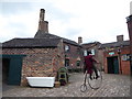
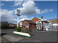
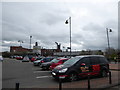
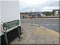
100 photos from this area
Area Information
Key information about the ST3 1PR including its size, population, and administrative classification.
- Area Type
- Postcode
- Area Size
- 9492 m²
- Population
- 1818
- Population Density
- 1651 people/km²
House Prices in ST3 1PR
14
Properties
£51,938
Average Sold Price
£28,000
Lowest Price
£75,000
Highest Price
Showing 14 properties
| Address | Type | Beds | Baths | Last Sale Price | Last Sale Date | |
|---|---|---|---|---|---|---|
| 130 Normacot Road, Longton, Stoke On Trent, ST3 1PR | house | - | - | £53,500 | Mar 2022 | |
| 140 Normacot Road, Longton, Stoke On Trent, ST3 1PR | Terraced | 2 | 1 | £60,000 | Apr 2021 | |
| 146 Normacot Road, Longton, Stoke On Trent, ST3 1PR | house | - | - | £49,000 | Nov 2020 | |
| 138 Normacot Road, Longton, Stoke On Trent, ST3 1PR | Terraced | 2 | 1 | £75,000 | Oct 2018 | |
| 144 Normacot Road, Longton, Stoke On Trent, ST3 1PR | Terraced | - | - | £55,000 | Mar 2017 | |
| 148 Normacot Road, Longton, Stoke On Trent, ST3 1PR | Terraced | 3 | 1 | £45,000 | Nov 2009 | |
| 142 Normacot Road, Longton, Stoke On Trent, ST3 1PR | Terraced | 2 | 1 | £50,000 | Jun 2005 | |
| 132 Normacot Road, Longton, Stoke On Trent, ST3 1PR | house | - | - | £28,000 | Feb 2004 | |
| 128 Normacot Road, Longton, Stoke On Trent, ST3 1PR | Terraced | 2 | - | - | - | |
| Stoke-on-trent City Council, Industry Suite - Ground Floor, Centre Of Refurbishment Excellence (core), Normacot Road, Longton, Stoke On Trent, ST3 1PR | Office | - | - | - | - |
Page 1 of 2
Energy Efficiency in ST3 1PR
Amenities
Schools
| Rank | School | Type | Entry gender | Ages |
|---|
Explore more schools in this area
Go to Schools tabDemographics
Household Size
One person
most common
Accommodation Type
Houses
most common
Tenure
42
majority
Ethnic Group
White
most common
Religion
N/A
most common
Household Composition
N/A
most common
Age
47
median
Adults (30-64 years)
most common
Household Deprivation
N/A
with no deprivation
NS-SEC
17
in Lower managerial occupations
Explore more demographic insights in this area
Go to Demographics tabPlanning
Planning Constraints
- Flood RiskPremium
- Ramsar Wetland SitesPremium
- Area of Outstanding Natural BeautyPremium
- Protected Nature ReservePremium
- Protected WoodlandPremium