Area Overview for ST21 6RP
Photos of ST21 6RP
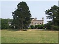
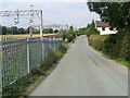
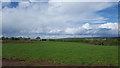
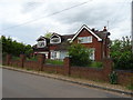


16 photos from this area
Area Information
Key information about the ST21 6RP including its size, population, and administrative classification.
- Area Type
- Postcode
- Area Size
- 38.8 hectares
- Population
- 1572
- Population Density
- 40 people/km²
House Prices in ST21 6RP
28
Properties
£306,554
Average Sold Price
£27,000
Lowest Price
£738,000
Highest Price
Showing 28 properties
| Address | Type | Beds | Baths | Last Sale Price | Last Sale Date | |
|---|---|---|---|---|---|---|
| Sedgefield House, Mill Lane, Standon, Stafford, ST21 6RP | Detached | 4 | - | £738,000 | Jun 2022 | |
| Oakley House, Mill Lane, Standon, Stafford, ST21 6RP | Detached | 4 | 3 | £475,000 | Nov 2021 | |
| The Haven, Mill Lane, Standon, Stafford, ST21 6RP | Semi-detached | 4 | 2 | £280,000 | Jan 2021 | |
| Fairview, Mill Lane, Standon, Stafford, ST21 6RP | Bungalow | 2 | 1 | £350,000 | Sep 2020 | |
| Springslade, Mill Lane, Standon, Stafford, ST21 6RP | Detached | 5 | 4 | £508,750 | Jun 2019 | |
| Barn Owl Cottage, Mill Lane, Standon, Stafford, ST21 6RP | Detached | 4 | 2 | £420,000 | Dec 2017 | |
| Sycamore Lodge, Mill Lane, Standon, Stafford, ST21 6RP | Detached | 5 | 3 | £467,500 | Jun 2016 | |
| 6 Mill Lane, Standon, Stafford, ST21 6RP | Semi-detached | 3 | - | £197,000 | Jul 2014 | |
| Stableview, Mill Lane, Standon, Stafford, ST21 6RP | house | - | - | £316,000 | Aug 2013 | |
| 2 Mill Lane, Standon, Stafford, ST21 6RP | Semi-detached | 3 | 2 | £134,000 | Mar 2012 |
Page 1 of 3
Energy Efficiency in ST21 6RP
Amenities
Schools
| Rank | School | Type | Entry gender | Ages |
|---|
Explore more schools in this area
Go to Schools tabDemographics
Household Size
Two person
most common
Accommodation Type
Houses
most common
Tenure
80
majority
Ethnic Group
White
most common
Religion
N/A
most common
Household Composition
N/A
most common
Age
47
median
Adults (30-64 years)
most common
Household Deprivation
N/A
with no deprivation
NS-SEC
39
in Lower managerial occupations
Explore more demographic insights in this area
Go to Demographics tabPlanning
Planning Constraints
- Flood RiskPremium
- Ramsar Wetland SitesPremium
- Area of Outstanding Natural BeautyPremium
- Protected Nature ReservePremium
- Protected WoodlandPremium