Area Overview for ST21 6QA
Photos of ST21 6QA
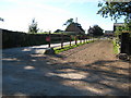
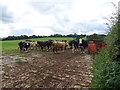
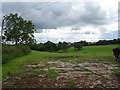
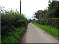
8 photos from this area
Area Information
Key information about the ST21 6QA including its size, population, and administrative classification.
- Area Type
- Postcode
- Area Size
- 78.8 hectares
- Population
- 1572
- Population Density
- 40 people/km²
House Prices in ST21 6QA
8
Properties
£516,667
Average Sold Price
£385,000
Lowest Price
£675,000
Highest Price
Showing 8 properties
| Address | Type | Beds | Baths | Last Sale Price | Last Sale Date | |
|---|---|---|---|---|---|---|
| Arn Hill House, Arn Hill, Croxton, Stafford, ST21 6QA | Detached | 5 | 2 | £675,000 | Jul 2015 | |
| Astage Farmhouse, Arn Hill, Croxton, Stafford, ST21 6QA | house | - | - | £385,000 | Mar 2013 | |
| Waterloo Cottage, Arn Hill, Croxton, Stafford, ST21 6QA | Detached | - | - | £490,000 | Jun 2006 | |
| New House Farm, Arn Hill, Croxton, Stafford, ST21 6QA | Farm | - | - | - | - | |
| Brooklyn Farm, Whittington Lane, Charnes, Croxton, ST21 6QA | Farm | - | - | - | - | |
| Arnhill Cottage, Arn Hill, Croxton, Stafford, ST21 6QA | house | - | - | - | - | |
| Greenacres, Arn Hill, Croxton, Stafford, ST21 6QA | Detached | - | - | - | - | |
| New House Farmhouse, Arn Hill, Croxton, Stafford, ST21 6QA | Semi-detached | - | - | - | - |
Energy Efficiency in ST21 6QA
Amenities
Schools
| Rank | School | Type | Entry gender | Ages |
|---|
Explore more schools in this area
Go to Schools tabDemographics
Household Size
Two person
most common
Accommodation Type
Houses
most common
Tenure
80
majority
Ethnic Group
White
most common
Religion
N/A
most common
Household Composition
N/A
most common
Age
47
median
Adults (30-64 years)
most common
Household Deprivation
N/A
with no deprivation
NS-SEC
39
in Lower managerial occupations
Explore more demographic insights in this area
Go to Demographics tabPlanning
Planning Constraints
- Flood RiskPremium
- Ramsar Wetland SitesPremium
- Area of Outstanding Natural BeautyPremium
- Protected Nature ReservePremium
- Protected WoodlandPremium