Area Overview for ST21 6LX
Photos of ST21 6LX

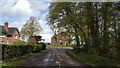
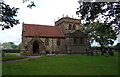

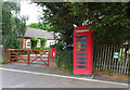

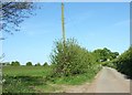


14 photos from this area
Area Information
Key information about the ST21 6LX including its size, population, and administrative classification.
- Area Type
- Postcode
- Area Size
- 3.1 km²
- Population
- 1572
- Population Density
- 40 people/km²
House Prices in ST21 6LX
42
Properties
£379,564
Average Sold Price
£120,000
Lowest Price
£885,000
Highest Price
Showing 42 properties
| Address | Type | Beds | Baths | Last Sale Price | Last Sale Date | |
|---|---|---|---|---|---|---|
| Swallow Barn, Slindon Road, Slindon, Stafford, ST21 6LX | house | - | - | £322,400 | Jan 2022 | |
| 1, Yew Tree Cottages, Slindon Road, Slindon, Stafford, ST21 6LX | house | - | - | £285,000 | Dec 2021 | |
| Red Lion Farm, Slindon Road, Slindon, Stafford, ST21 6LX | Detached | 4 | - | £680,000 | Jul 2020 | |
| Appledene, Slindon Road, Slindon, Stafford, ST21 6LX | Semi-detached | 5 | 2 | £386,000 | Jun 2020 | |
| Springfield, Slindon Road, Slindon, Stafford, ST21 6LX | Bungalow | 3 | 1 | £299,500 | Jan 2020 | |
| The Old Smithy, Slindon Road, Slindon, Stafford, ST21 6LX | Detached | 4 | 2 | £520,000 | Jul 2019 | |
| Cherry Orchard Bungalow, Slindon Road, Slindon, Stafford, ST21 6LX | Bungalow | 2 | 1 | £172,500 | Jun 2019 | |
| The Rise, Slindon Road, Slindon, Stafford, ST21 6LX | Detached | 4 | 2 | £550,000 | May 2019 | |
| Aspley Villa, Aspley Lane, Slindon, Stafford, ST21 6LX | house | - | - | £195,000 | Mar 2019 | |
| Old Barns, Slindon Road, Slindon, Stafford, ST21 6LX | Retail | 6 | 3 | £885,000 | May 2017 |
Page 1 of 5
Energy Efficiency in ST21 6LX
Amenities
Schools
| Rank | School | Type | Entry gender | Ages |
|---|
Explore more schools in this area
Go to Schools tabDemographics
Household Size
Two person
most common
Accommodation Type
Houses
most common
Tenure
80
majority
Ethnic Group
White
most common
Religion
N/A
most common
Household Composition
N/A
most common
Age
47
median
Adults (30-64 years)
most common
Household Deprivation
N/A
with no deprivation
NS-SEC
39
in Lower managerial occupations
Explore more demographic insights in this area
Go to Demographics tabPlanning
Planning Constraints
- Flood RiskPremium
- Ramsar Wetland SitesPremium
- Area of Outstanding Natural BeautyPremium
- Protected Nature ReservePremium
- Protected WoodlandPremium