Area Overview for ST20 0EZ
Photos of ST20 0EZ
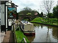
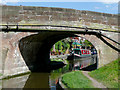
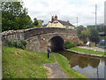

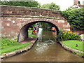
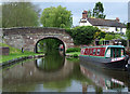
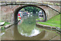
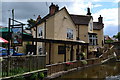
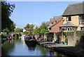

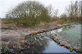
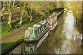
72 photos from this area
Area Information
Key information about the ST20 0EZ including its size, population, and administrative classification.
- Area Type
- Postcode
- Area Size
- 7.0 hectares
- Population
- 1424
- Population Density
- 1543 people/km²
House Prices in ST20 0EZ
22
Properties
£179,084
Average Sold Price
£88,500
Lowest Price
£300,000
Highest Price
Showing 22 properties
| Address | Type | Beds | Baths | Last Sale Price | Last Sale Date | |
|---|---|---|---|---|---|---|
| Ed-cavil, Station Road, Gnosall, Stafford, ST20 0EZ | Terraced | 2 | 2 | £239,000 | Aug 2025 | |
| Pamasi, Station Road, Gnosall, Stafford, ST20 0EZ | Terraced | 3 | 1 | £125,000 | Dec 2024 | |
| Long Bailey, Station Road, Gnosall, Stafford, ST20 0EZ | Bungalow | 3 | 1 | £300,000 | Dec 2022 | |
| Tid Apa, Station Road, Gnosall, Stafford, ST20 0EZ | Bungalow | 3 | 1 | £230,000 | Feb 2020 | |
| Turnpike Cottage, Station Road, Gnosall, Stafford, ST20 0EZ | Terraced | 2 | 1 | £127,000 | Aug 2013 | |
| Brookside, Station Road, Gnosall, Stafford, ST20 0EZ | Bungalow | - | - | £89,173 | Apr 2011 | |
| Lockwood, Station Road, Gnosall, Stafford, ST20 0EZ | Detached | - | - | £234,000 | May 2007 | |
| The Knot, Station Road, Gnosall, Stafford, ST20 0EZ | Semi-detached | - | - | £88,500 | Jul 2000 | |
| Dunromin Cottage, Station Road, Gnosall, Stafford, ST20 0EZ | Terraced | 2 | 1 | - | - | |
| Flat, 1 Station Road, Gnosall, Stafford, ST20 0EZ | Flat | - | - | - | - |
Page 1 of 3
Energy Efficiency in ST20 0EZ
Amenities
Schools
| Rank | School | Type | Entry gender | Ages |
|---|
Explore more schools in this area
Go to Schools tabDemographics
Household Size
One person
most common
Accommodation Type
Houses
most common
Tenure
64
majority
Ethnic Group
White
most common
Religion
N/A
most common
Household Composition
N/A
most common
Age
47
median
Adults (30-64 years)
most common
Household Deprivation
N/A
with no deprivation
NS-SEC
33
in Lower managerial occupations
Explore more demographic insights in this area
Go to Demographics tabPlanning
Planning Constraints
- Flood RiskPremium
- Ramsar Wetland SitesPremium
- Area of Outstanding Natural BeautyPremium
- Protected Nature ReservePremium
- Protected WoodlandPremium