Area Overview for ST20 0AY
Photos of ST20 0AY


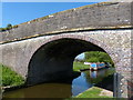
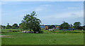


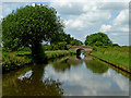
34 photos from this area
Area Information
Key information about the ST20 0AY including its size, population, and administrative classification.
- Area Type
- Postcode
- Area Size
- 55.3 hectares
- Population
- 2402
- Population Density
- 51 people/km²
House Prices in ST20 0AY
11
Properties
£293,875
Average Sold Price
£112,000
Lowest Price
£500,000
Highest Price
Showing 11 properties
| Address | Type | Beds | Baths | Last Sale Price | Last Sale Date | |
|---|---|---|---|---|---|---|
| Meadowside, Little Onn Road, Little Onn, Stafford, ST20 0AY | house | 4 | - | £500,000 | Aug 2011 | |
| 5 Little Onn Road, Little Onn, Stafford, ST20 0AY | house | - | - | £336,000 | Apr 2011 | |
| 2 Little Onn Road, Little Onn, Stafford, ST20 0AY | Semi-detached | - | - | £227,500 | Aug 2006 | |
| 4 Little Onn Road, Little Onn, Stafford, ST20 0AY | Semi-detached | - | - | £112,000 | Dec 2001 | |
| 3 Little Onn Road, Little Onn, Stafford, ST20 0AY | Semi-detached | - | - | - | - | |
| 1 Little Onn Road, Little Onn, Stafford, ST20 0AY | Semi-detached | - | - | - | - | |
| 6 Little Onn Road, Marston, Stafford, ST20 0AY | undefined | - | - | - | - | |
| Caravan Site, Little Onn Road, Little Onn, Stafford, ST20 0AY | undefined | - | - | - | - | |
| Caravan, 5 Little Onn Road, Little Onn, Stafford, ST20 0AY | Mobile Home | - | - | - | - | |
| Malt Shovel Farm, Little Onn Road, Little Onn, Stafford, ST20 0AY | house | - | - | - | - |
Page 1 of 2
Energy Efficiency in ST20 0AY
Amenities
Schools
| Rank | School | Type | Entry gender | Ages |
|---|
Explore more schools in this area
Go to Schools tabDemographics
Household Size
Two person
most common
Accommodation Type
Houses
most common
Tenure
75
majority
Ethnic Group
White
most common
Religion
N/A
most common
Household Composition
N/A
most common
Age
47
median
Adults (30-64 years)
most common
Household Deprivation
N/A
with no deprivation
NS-SEC
44
in Lower managerial occupations
Explore more demographic insights in this area
Go to Demographics tabPlanning
Planning Constraints
- Flood RiskPremium
- Ramsar Wetland SitesPremium
- Area of Outstanding Natural BeautyPremium
- Protected Nature ReservePremium
- Protected WoodlandPremium