Area Overview for ST2 9NW
Photos of ST2 9NW
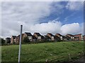
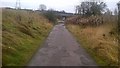
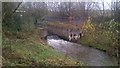
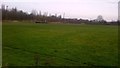
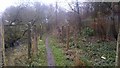

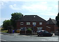
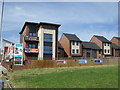
18 photos from this area
Area Information
Key information about the ST2 9NW including its size, population, and administrative classification.
- Area Type
- Postcode
- Area Size
- 4313 m²
- Population
- 1217
- Population Density
- 3815 people/km²
House Prices in ST2 9NW
14
Properties
£113,938
Average Sold Price
£14,500
Lowest Price
£200,000
Highest Price
Showing 14 properties
| Address | Type | Beds | Baths | Last Sale Price | Last Sale Date | |
|---|---|---|---|---|---|---|
| 151 Debenham Crescent, Eaton Park, Stoke On Trent, ST2 9NW | Bungalow | - | - | £119,000 | Aug 2023 | |
| 143 Debenham Crescent, Eaton Park, Stoke On Trent, ST2 9NW | Semi-detached | 2 | - | £105,000 | Nov 2021 | |
| 165 Debenham Crescent, Eaton Park, Stoke On Trent, ST2 9NW | Semi-detached | 3 | 1 | £200,000 | Aug 2021 | |
| 161 Debenham Crescent, Eaton Park, Stoke On Trent, ST2 9NW | house | 3 | - | £188,000 | Jan 2021 | |
| 147 Debenham Crescent, Eaton Park, Stoke On Trent, ST2 9NW | Bungalow | 2 | 1 | £102,000 | Feb 2018 | |
| 139 Debenham Crescent, Eaton Park, Stoke On Trent, ST2 9NW | Bungalow | - | - | £88,000 | Oct 2014 | |
| 141 Debenham Crescent, Eaton Park, Stoke On Trent, ST2 9NW | Bungalow | 2 | 1 | £95,000 | Aug 2013 | |
| 155 Debenham Crescent, Eaton Park, Stoke On Trent, ST2 9NW | Terraced | - | - | £14,500 | Feb 1996 | |
| 153 Debenham Crescent, Eaton Park, Stoke On Trent, ST2 9NW | Terraced | 2 | 1 | - | - | |
| 163 Debenham Crescent, Eaton Park, Stoke On Trent, ST2 9NW | Terraced | - | - | - | - |
Page 1 of 2
Energy Efficiency in ST2 9NW
Amenities
Schools
| Rank | School | Type | Entry gender | Ages |
|---|
Explore more schools in this area
Go to Schools tabDemographics
Household Size
Two person
most common
Accommodation Type
Houses
most common
Tenure
92
majority
Ethnic Group
White
most common
Religion
N/A
most common
Household Composition
N/A
most common
Age
47
median
Adults (30-64 years)
most common
Household Deprivation
N/A
with no deprivation
NS-SEC
18
in Lower managerial occupations
Explore more demographic insights in this area
Go to Demographics tabPlanning
Planning Constraints
- Flood RiskPremium
- Ramsar Wetland SitesPremium
- Area of Outstanding Natural BeautyPremium
- Protected Nature ReservePremium
- Protected WoodlandPremium