Area Overview for ST2 9AG
Photos of ST2 9AG

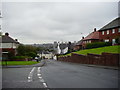
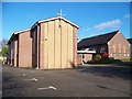
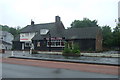

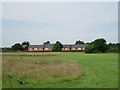

18 photos from this area
Area Information
Key information about the ST2 9AG including its size, population, and administrative classification.
- Area Type
- Postcode
- Area Size
- 1.4 hectares
- Population
- 1577
- Population Density
- 2999 people/km²
House Prices in ST2 9AG
20
Properties
£101,350
Average Sold Price
£50,000
Lowest Price
£136,000
Highest Price
Showing 20 properties
| Address | Type | Beds | Baths | Last Sale Price | Last Sale Date | |
|---|---|---|---|---|---|---|
| 63 Werrington Road, Bucknall, Stoke On Trent, ST2 9AG | Terraced | 2 | 1 | £81,000 | Dec 2024 | |
| 41 Werrington Road, Bucknall, Stoke On Trent, ST2 9AG | Detached | 3 | 1 | £130,000 | Apr 2024 | |
| 39 Werrington Road, Bucknall, Stoke On Trent, ST2 9AG | Detached | 3 | 1 | £127,500 | Jul 2020 | |
| 65 Werrington Road, Bucknall, Stoke On Trent, ST2 9AG | house | 3 | - | £50,000 | Jan 2019 | |
| 43 Werrington Road, Bucknall, Stoke On Trent, ST2 9AG | Detached | 3 | 1 | £136,000 | Sep 2018 | |
| 61 Werrington Road, Bucknall, Stoke On Trent, ST2 9AG | Retail | 3 | 1 | £55,000 | Dec 2010 | |
| 45 Werrington Road, Bucknall, Stoke On Trent, ST2 9AG | Detached | - | - | £129,950 | Jun 2005 | |
| 83 Werrington Road, Bucknall, Stoke On Trent, ST2 9AG | Terraced | - | - | - | - | |
| 73 Werrington Road, Bucknall, Stoke On Trent, ST2 9AG | Bungalow | - | - | - | - | |
| 47 Werrington Road, Bucknall, Stoke On Trent, ST2 9AG | Detached | - | - | - | - |
Page 1 of 2
Energy Efficiency in ST2 9AG
Amenities
Schools
| Rank | School | Type | Entry gender | Ages |
|---|
Explore more schools in this area
Go to Schools tabDemographics
Household Size
Two person
most common
Accommodation Type
Houses
most common
Tenure
56
majority
Ethnic Group
White
most common
Religion
N/A
most common
Household Composition
N/A
most common
Age
47
median
Adults (30-64 years)
most common
Household Deprivation
N/A
with no deprivation
NS-SEC
17
in Lower managerial occupations
Explore more demographic insights in this area
Go to Demographics tabPlanning
Planning Constraints
- Flood RiskPremium
- Ramsar Wetland SitesPremium
- Area of Outstanding Natural BeautyPremium
- Protected Nature ReservePremium
- Protected WoodlandPremium