Area Overview for ST2 8LY
Photos of ST2 8LY
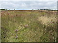
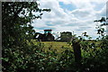
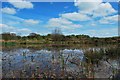
3 photos from this area
Area Information
Key information about the ST2 8LY including its size, population, and administrative classification.
- Area Type
- Postcode
- Area Size
- 1.3 km²
- Population
- 1661
- Population Density
- 442 people/km²
House Prices in ST2 8LY
46
Properties
£251,936
Average Sold Price
£59,950
Lowest Price
£500,000
Highest Price
Showing 46 properties
| Address | Type | Beds | Baths | Last Sale Price | Last Sale Date | |
|---|---|---|---|---|---|---|
| Holding, 2 Eaves Lane, Bucknall, Stoke On Trent, ST2 8LY | Semi-detached | 4 | 3 | £405,000 | Feb 2025 | |
| Trieste, Eaves Lane, Armshead, ST2 8LY | Bungalow | - | - | £275,000 | Dec 2021 | |
| Eaves Farm, Eaves Lane, Armshead, ST2 8LY | Detached | 3 | 1 | £500,000 | Jan 2021 | |
| Moorside Farm, Eaves Lane, Armshead, ST2 8LY | Detached | 3 | 4 | £385,000 | Mar 2019 | |
| The Jays, Eaves Lane, Bucknall, Stoke On Trent, ST2 8LY | Bungalow | 4 | 2 | £245,000 | Oct 2017 | |
| 155 Eaves Lane, Bucknall, Stoke On Trent, ST2 8LY | Detached | 3 | 2 | £293,750 | Jul 2017 | |
| 149 Eaves Lane, Bucknall, Stoke On Trent, ST2 8LY | Bungalow | 3 | - | £172,500 | May 2015 | |
| 151 Eaves Lane, Bucknall, Stoke On Trent, ST2 8LY | house | - | - | £125,100 | Aug 2009 | |
| Holding, 3 Eaves Lane, Bucknall, Stoke On Trent, ST2 8LY | Semi-detached | - | - | £150,000 | Jan 2005 | |
| 153 Eaves Lane, Bucknall, Stoke On Trent, ST2 8LY | Semi-detached | - | - | £160,000 | Jul 2004 |
Page 1 of 5
Energy Efficiency in ST2 8LY
Amenities
Schools
| Rank | School | Type | Entry gender | Ages |
|---|
Explore more schools in this area
Go to Schools tabDemographics
Household Size
Two person
most common
Accommodation Type
Houses
most common
Tenure
93
majority
Ethnic Group
White
most common
Religion
N/A
most common
Household Composition
N/A
most common
Age
47
median
Adults (30-64 years)
most common
Household Deprivation
N/A
with no deprivation
NS-SEC
33
in Lower managerial occupations
Explore more demographic insights in this area
Go to Demographics tabPlanning
Planning Constraints
- Flood RiskPremium
- Ramsar Wetland SitesPremium
- Area of Outstanding Natural BeautyPremium
- Protected Nature ReservePremium
- Protected WoodlandPremium