Area Overview for ST2 7AA
Photos of ST2 7AA
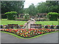
14 photos from this area
Area Information
Key information about the ST2 7AA including its size, population, and administrative classification.
- Area Type
- Postcode
- Area Size
- 13.7 hectares
- Population
- 2329
- Population Density
- 2085 people/km²
House Prices in ST2 7AA
47
Properties
£115,544
Average Sold Price
£47,000
Lowest Price
£227,000
Highest Price
Showing 47 properties
| Address | Type | Beds | Baths | Last Sale Price | Last Sale Date | |
|---|---|---|---|---|---|---|
| 1761 Leek Road, Stoke On Trent, ST2 7AA | Semi-detached | 3 | 1 | £220,000 | Mar 2025 | |
| 1749 Leek Road, Stoke On Trent, ST2 7AA | Semi-detached | 2 | 1 | £122,000 | May 2024 | |
| 1759 Leek Road, Stoke On Trent, ST2 7AA | Semi-detached | 3 | 1 | £138,000 | Dec 2023 | |
| 1757 Leek Road, Stoke On Trent, ST2 7AA | Semi-detached | 2 | 1 | £151,151 | Sep 2023 | |
| 1689 Leek Road, Stoke On Trent, ST2 7AA | Semi-detached | 3 | 1 | £167,000 | May 2023 | |
| 1685 Leek Road, Stoke On Trent, ST2 7AA | house | - | - | £130,500 | Mar 2022 | |
| 1709 Leek Road, Stoke On Trent, ST2 7AA | house | - | - | £120,000 | Nov 2019 | |
| 1731 Leek Road, Stoke On Trent, ST2 7AA | Semi-detached | 3 | 1 | £139,950 | Oct 2018 | |
| 1737 Leek Road, Stoke On Trent, ST2 7AA | Semi-detached | 3 | 1 | £116,000 | Feb 2018 | |
| 1681 Leek Road, Stoke On Trent, ST2 7AA | house | 2 | 1 | £117,950 | Dec 2017 |
Page 1 of 5
Energy Efficiency in ST2 7AA
Amenities
Schools
| Rank | School | Type | Entry gender | Ages |
|---|
Explore more schools in this area
Go to Schools tabDemographics
Household Size
Two person
most common
Accommodation Type
Houses
most common
Tenure
69
majority
Ethnic Group
White
most common
Religion
N/A
most common
Household Composition
N/A
most common
Age
47
median
Adults (30-64 years)
most common
Household Deprivation
N/A
with no deprivation
NS-SEC
29
in Lower managerial occupations
Explore more demographic insights in this area
Go to Demographics tabPlanning
Planning Constraints
- Flood RiskPremium
- Ramsar Wetland SitesPremium
- Area of Outstanding Natural BeautyPremium
- Protected Nature ReservePremium
- Protected WoodlandPremium