Area Overview for ST19 9ER
Photos of ST19 9ER
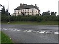


24 photos from this area
Area Information
Key information about the ST19 9ER including its size, population, and administrative classification.
- Area Type
- Postcode
- Area Size
- 17.7 hectares
- Population
- 1528
- Population Density
- 40 people/km²
House Prices in ST19 9ER
5
Properties
£467,625
Average Sold Price
£438,000
Lowest Price
£492,500
Highest Price
Showing 5 properties
| Address | Type | Beds | Baths | Last Sale Price | Last Sale Date | |
|---|---|---|---|---|---|---|
| Weston View, Watery Bank, Ivetsey Bank, ST19 9ER | Semi-detached | 4 | 3 | £455,000 | Aug 2020 | |
| Watling Barn, Watery Bank, Ivetsey Bank, ST19 9ER | Semi-detached | 3 | 3 | £438,000 | May 2019 | |
| Church View Barn, Watery Bank, Ivetsey Bank, ST19 9ER | Semi-detached | 3 | 2 | £492,500 | Oct 2016 | |
| Morbrook Barn, Watery Bank, Ivetsey Bank, ST19 9ER | Semi-detached | 4 | 4 | £485,000 | Sep 2008 | |
| Bishops Barn, Watery Bank, Ivetsey Bank, ST19 9ER | Terraced | - | - | - | - |
Energy Efficiency in ST19 9ER
Amenities
Schools
| Rank | School | Type | Entry gender | Ages |
|---|
Explore more schools in this area
Go to Schools tabDemographics
Household Size
Two person
most common
Accommodation Type
Houses
most common
Tenure
68
majority
Ethnic Group
White
most common
Religion
N/A
most common
Household Composition
N/A
most common
Age
47
median
Adults (30-64 years)
most common
Household Deprivation
N/A
with no deprivation
NS-SEC
43
in Lower managerial occupations
Explore more demographic insights in this area
Go to Demographics tabPlanning
Planning Constraints
- Flood RiskPremium
- Ramsar Wetland SitesPremium
- Area of Outstanding Natural BeautyPremium
- Protected Nature ReservePremium
- Protected WoodlandPremium