Area Overview for ST19 5ST
Photos of ST19 5ST
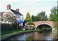
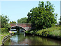
79 photos from this area
Area Information
Key information about the ST19 5ST including its size, population, and administrative classification.
- Area Type
- Postcode
- Area Size
- 1.3 hectares
- Population
- 1680
- Population Density
- 4086 people/km²
House Prices in ST19 5ST
21
Properties
£219,060
Average Sold Price
£72,500
Lowest Price
£400,000
Highest Price
Showing 21 properties
| Address | Type | Beds | Baths | Last Sale Price | Last Sale Date | |
|---|---|---|---|---|---|---|
| 11 St Modwena Way, Penkridge, ST19 5ST | house | - | - | £400,000 | Aug 2023 | |
| 1 St Modwena Way, Penkridge, ST19 5ST | Detached | 4 | 2 | £323,500 | Feb 2020 | |
| 16 St Modwena Way, Penkridge, ST19 5ST | Detached | 4 | 2 | £305,000 | Jan 2020 | |
| 3 St Modwena Way, Penkridge, ST19 5ST | Detached | 4 | 2 | £297,000 | Dec 2019 | |
| 9 St Modwena Way, Penkridge, ST19 5ST | house | 4 | - | £325,000 | Jul 2018 | |
| 4 St Modwena Way, Penkridge, ST19 5ST | Detached | 4 | 1 | £319,000 | Jan 2018 | |
| 5 St Modwena Way, Penkridge, ST19 5ST | house | - | - | £240,000 | Sep 2014 | |
| 25 St Modwena Way, Penkridge, ST19 5ST | Detached | - | - | £246,000 | Apr 2006 | |
| 27 St Modwena Way, Penkridge, ST19 5ST | Detached | - | - | £180,000 | Oct 2003 | |
| 8 St Modwena Way, Penkridge, ST19 5ST | Detached | - | - | £179,950 | Oct 2002 |
Page 1 of 3
Energy Efficiency in ST19 5ST
Amenities
Schools
| Rank | School | Type | Entry gender | Ages |
|---|
Explore more schools in this area
Go to Schools tabDemographics
Household Size
Family (3-5 people)
most common
Accommodation Type
Houses
most common
Tenure
87
majority
Ethnic Group
White
most common
Religion
N/A
most common
Household Composition
N/A
most common
Age
47
median
Adults (30-64 years)
most common
Household Deprivation
N/A
with no deprivation
NS-SEC
43
in Lower managerial occupations
Explore more demographic insights in this area
Go to Demographics tabPlanning
Planning Constraints
- Flood RiskPremium
- Ramsar Wetland SitesPremium
- Area of Outstanding Natural BeautyPremium
- Protected Nature ReservePremium
- Protected WoodlandPremium