Area Overview for ST19 5RN
Photos of ST19 5RN
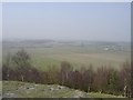
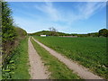
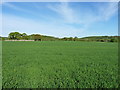
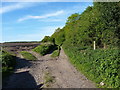
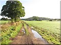
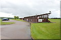
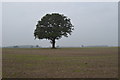
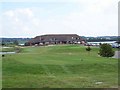
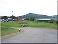
9 photos from this area
Area Information
Key information about the ST19 5RN including its size, population, and administrative classification.
- Area Type
- Postcode
- Area Size
- 2.4 km²
- Population
- 2412
- Population Density
- 217 people/km²
House Prices in ST19 5RN
22
Properties
-
Average Sold Price
-
Lowest Price
-
Highest Price
Showing 22 properties
| Address | Type | Beds | Baths | Last Sale Price | Last Sale Date | |
|---|---|---|---|---|---|---|
| 2, Yewtree Cottages, Pottal Pool Road, Penkridge, ST19 5RN | house | 2 | 1 | - | - | |
| Yew Tree Farm, Pottal Pool Road, Penkridge, ST19 5RN | Semi-detached | 2 | 2 | - | - | |
| Oaklands Farm, Pottal Pool Road, Penkridge, ST19 5RN | Semi-detached | 2 | 1 | - | - | |
| Rugeley And District Masonic Company, The Chase Golf Club, Pottal Pool Road, Penkridge, ST19 5RN | Office | - | - | - | - | |
| The Bus Stop, Mad Ford Engineering, Pottal Pool Road, Penkridge, ST19 5RN | Mobile Home | - | - | - | - | |
| The Dairy, Yew Tree Farm, Pottal Pool Road, Penkridge, ST19 5RN | Semi-detached | - | - | - | - | |
| Auctioneers Stores, The Chase Golf Club, Pottal Pool Road, Penkridge, ST19 5RN | warehouse | - | - | - | - | |
| Acupuncturist, The Chase Golf Club, Pottal Pool Road, Penkridge, ST19 5RN | commercial | - | - | - | - | |
| 4, Yewtree Cottages, Pottal Pool Road, Penkridge, ST19 5RN | Semi-detached | - | - | - | - | |
| 3, Yewtree Cottages, Pottal Pool Road, Penkridge, ST19 5RN | Semi-detached | - | - | - | - |
Page 1 of 3
Energy Efficiency in ST19 5RN
Amenities
Schools
| Rank | School | Type | Entry gender | Ages |
|---|
Explore more schools in this area
Go to Schools tabDemographics
Household Size
Family (3-5 people)
most common
Accommodation Type
Houses
most common
Tenure
67
majority
Ethnic Group
White
most common
Religion
N/A
most common
Household Composition
N/A
most common
Age
47
median
Adults (30-64 years)
most common
Household Deprivation
N/A
with no deprivation
NS-SEC
32
in Lower managerial occupations
Explore more demographic insights in this area
Go to Demographics tabPlanning
Planning Constraints
- Flood RiskPremium
- Ramsar Wetland SitesPremium
- Area of Outstanding Natural BeautyPremium
- Protected Nature ReservePremium
- Protected WoodlandPremium