Area Overview for ST19 5PR
Photos of ST19 5PR


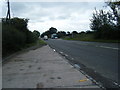


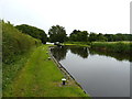
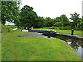
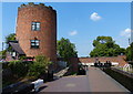


92 photos from this area
Area Information
Key information about the ST19 5PR including its size, population, and administrative classification.
- Area Type
- Postcode
- Area Size
- 2.2 km²
- Population
- 2059
- Population Density
- 150 people/km²
House Prices in ST19 5PR
44
Properties
£274,954
Average Sold Price
£84,995
Lowest Price
£894,000
Highest Price
Showing 44 properties
| Address | Type | Beds | Baths | Last Sale Price | Last Sale Date | |
|---|---|---|---|---|---|---|
| Clovelly, Watling Street, Gailey, ST19 5PR | Bungalow | 4 | 2 | £894,000 | Jun 2022 | |
| Hollythorn Cottage, Watling Street, Gailey, ST19 5PR | house | - | - | £475,000 | Mar 2021 | |
| Chase View House, Watling Street, Gailey, ST19 5PR | Detached | - | - | £200,000 | Feb 2019 | |
| Lakeview House, Watling Street, Gailey, ST19 5PR | Detached | - | - | £250,000 | May 2017 | |
| Scholars Gate, Watling Street, Gailey, ST19 5PR | Bungalow | - | - | £332,500 | Sep 2014 | |
| Trewern, Watling Street, Gailey, ST19 5PR | house | - | - | £150,000 | Sep 2009 | |
| Wharf House, Watling Street, Gailey, ST19 5PR | Detached | - | - | £160,000 | Jul 2008 | |
| Hamerton House, Watling Street, Gailey, ST19 5PR | Detached | 5 | 3 | £240,000 | Apr 2002 | |
| Wheatcroft, Watling Street, Gailey, ST19 5PR | Semi-detached | - | - | £84,995 | Dec 1999 | |
| Eastfield, Watling Street, Gailey, ST19 5PR | Semi-detached | - | - | £100,000 | May 1999 |
Page 1 of 5
Energy Efficiency in ST19 5PR
Amenities
Schools
| Rank | School | Type | Entry gender | Ages |
|---|
Explore more schools in this area
Go to Schools tabDemographics
Household Size
Two person
most common
Accommodation Type
Houses
most common
Tenure
70
majority
Ethnic Group
White
most common
Religion
N/A
most common
Household Composition
N/A
most common
Age
47
median
Adults (30-64 years)
most common
Household Deprivation
N/A
with no deprivation
NS-SEC
37
in Lower managerial occupations
Explore more demographic insights in this area
Go to Demographics tabPlanning
Planning Constraints
- Flood RiskPremium
- Ramsar Wetland SitesPremium
- Area of Outstanding Natural BeautyPremium
- Protected Nature ReservePremium
- Protected WoodlandPremium