Area Overview for ST19 5AD
Photos of ST19 5AD
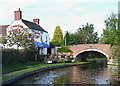
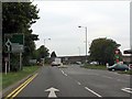
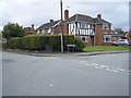
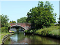
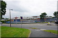
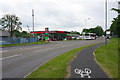
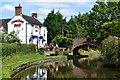
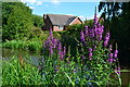
79 photos from this area
Area Information
Key information about the ST19 5AD including its size, population, and administrative classification.
- Area Type
- Postcode
- Area Size
- 3.1 hectares
- Population
- 2164
- Population Density
- 114 people/km²
House Prices in ST19 5AD
40
Properties
£247,592
Average Sold Price
£79,000
Lowest Price
£470,000
Highest Price
Showing 40 properties
| Address | Type | Beds | Baths | Last Sale Price | Last Sale Date | |
|---|---|---|---|---|---|---|
| 5 St Michaels Close, Penkridge, ST19 5AD | Detached | 4 | 2 | £470,000 | Jul 2025 | |
| 34 St Michaels Close, Penkridge, ST19 5AD | Detached | 4 | 2 | £425,000 | Sep 2023 | |
| 33 St Michaels Close, Penkridge, ST19 5AD | house | - | - | £415,000 | Jun 2021 | |
| 12 St Michaels Close, Penkridge, ST19 5AD | Detached | 4 | - | £448,000 | Mar 2021 | |
| 28 St Michaels Close, Penkridge, ST19 5AD | Detached | 4 | 2 | £300,000 | Jun 2020 | |
| 45 St Michaels Close, Penkridge, ST19 5AD | house | - | - | £340,000 | Feb 2017 | |
| 8 St Michaels Close, Penkridge, ST19 5AD | house | - | - | £310,000 | Aug 2015 | |
| 43 St Michaels Close, Penkridge, ST19 5AD | house | - | - | £375,000 | Aug 2015 | |
| 32 St Michaels Close, Penkridge, ST19 5AD | Detached | 4 | - | £280,000 | Apr 2014 | |
| 27 St Michaels Close, Penkridge, ST19 5AD | house | - | - | £249,950 | Jul 2012 |
Page 1 of 4
Energy Efficiency in ST19 5AD
Amenities
Schools
| Rank | School | Type | Entry gender | Ages |
|---|
Explore more schools in this area
Go to Schools tabDemographics
Household Size
Two person
most common
Accommodation Type
Houses
most common
Tenure
70
majority
Ethnic Group
White
most common
Religion
N/A
most common
Household Composition
N/A
most common
Age
47
median
Adults (30-64 years)
most common
Household Deprivation
N/A
with no deprivation
NS-SEC
34
in Lower managerial occupations
Explore more demographic insights in this area
Go to Demographics tabPlanning
Planning Constraints
- Flood RiskPremium
- Ramsar Wetland SitesPremium
- Area of Outstanding Natural BeautyPremium
- Protected Nature ReservePremium
- Protected WoodlandPremium