Area Overview for ST18 9PS
Photos of ST18 9PS
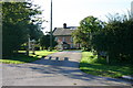
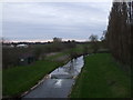

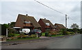
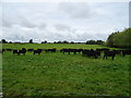
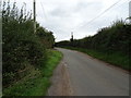
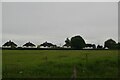
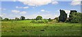
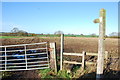
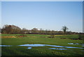
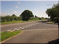
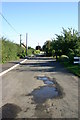
22 photos from this area
Area Information
Key information about the ST18 9PS including its size, population, and administrative classification.
- Area Type
- Postcode
- Area Size
- 13.3 hectares
- Population
- 2499
- Population Density
- 120 people/km²
House Prices in ST18 9PS
33
Properties
£190,577
Average Sold Price
£55,000
Lowest Price
£300,000
Highest Price
Showing 33 properties
| Address | Type | Beds | Baths | Last Sale Price | Last Sale Date | |
|---|---|---|---|---|---|---|
| Wendlin, Eccleshall Road, Great Bridgeford, Stafford, ST18 9PS | Semi-detached | 3 | 2 | £260,000 | Apr 2025 | |
| Bridge House, Eccleshall Road, Great Bridgeford, Stafford, ST18 9PS | house | 3 | 1 | £255,000 | Jan 2022 | |
| Sandford House, Eccleshall Road, Great Bridgeford, Stafford, ST18 9PS | Detached | 3 | 1 | £225,000 | Nov 2020 | |
| Rosyth, Eccleshall Road, Great Bridgeford, Stafford, ST18 9PS | Semi-detached | 3 | 1 | £205,000 | Oct 2020 | |
| Ancledph, Eccleshall Road, Great Bridgeford, Stafford, ST18 9PS | house | - | - | £150,000 | Oct 2019 | |
| Nefyn, Eccleshall Road, Great Bridgeford, Stafford, ST18 9PS | Semi-detached | 4 | 1 | £220,000 | Dec 2017 | |
| Ellanslea, Eccleshall Road, Great Bridgeford, Stafford, ST18 9PS | Detached | 2 | 2 | £108,000 | Jan 2016 | |
| The Cottage, Eccleshall Road, Great Bridgeford, Stafford, ST18 9PS | house | - | - | £300,000 | Jul 2014 | |
| Victoria Croft, Eccleshall Road, Great Bridgeford, Stafford, ST18 9PS | Detached | 7 | 3 | £290,000 | Feb 2014 | |
| Bridgeford Hurst Farm, Eccleshall Road, Great Bridgeford, Stafford, ST18 9PS | house | - | - | £135,000 | Mar 2012 |
Page 1 of 4
Energy Efficiency in ST18 9PS
Amenities
Schools
| Rank | School | Type | Entry gender | Ages |
|---|
Explore more schools in this area
Go to Schools tabDemographics
Household Size
Two person
most common
Accommodation Type
Houses
most common
Tenure
88
majority
Ethnic Group
White
most common
Religion
N/A
most common
Household Composition
N/A
most common
Age
47
median
Adults (30-64 years)
most common
Household Deprivation
N/A
with no deprivation
NS-SEC
45
in Lower managerial occupations
Explore more demographic insights in this area
Go to Demographics tabPlanning
Planning Constraints
- Flood RiskPremium
- Ramsar Wetland SitesPremium
- Area of Outstanding Natural BeautyPremium
- Protected Nature ReservePremium
- Protected WoodlandPremium