Area Overview for ST18 9PA
Photos of ST18 9PA
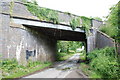
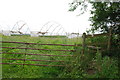


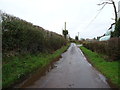
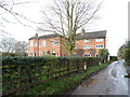

13 photos from this area
Area Information
Key information about the ST18 9PA including its size, population, and administrative classification.
- Area Type
- Postcode
- Area Size
- 81.3 hectares
- Population
- 2081
- Population Density
- 57 people/km²
House Prices in ST18 9PA
12
Properties
£350,500
Average Sold Price
£112,000
Lowest Price
£555,000
Highest Price
Showing 12 properties
| Address | Type | Beds | Baths | Last Sale Price | Last Sale Date | |
|---|---|---|---|---|---|---|
| Field House Barn, Long Lane, Haughton, Stafford, ST18 9PA | Semi-detached | 4 | 3 | £555,000 | Mar 2025 | |
| The Handfords Cottage, Long Lane, Derrington, Stafford, ST18 9PA | house | - | - | £535,000 | Jun 2021 | |
| Chaturley House, Long Lane, Haughton, Stafford, ST18 9PA | Detached | - | - | £200,000 | May 2003 | |
| Langley, Long Lane, Haughton, Stafford, ST18 9PA | Detached | - | - | £112,000 | Jul 1996 | |
| Inverglyn, Long Lane, Haughton, Stafford, ST18 9PA | Bungalow | 2 | 1 | - | - | |
| Branksome, Long Lane, Haughton, Stafford, ST18 9PA | Detached | - | - | - | - | |
| Handfords Farm Barn, Long Lane, Derrington, Stafford, ST18 9PA | Detached | - | - | - | - | |
| Bracken Barn, Long Lane, Haughton, Stafford, ST18 9PA | Detached | - | - | - | - | |
| Long Lane Farm, Long Lane, Haughton, Stafford, ST18 9PA | Farm | - | - | - | - | |
| Little Croft, Long Lane, Derrington, Stafford, ST18 9PA | Detached | - | - | - | - |
Page 1 of 2
Energy Efficiency in ST18 9PA
Amenities
Schools
| Rank | School | Type | Entry gender | Ages |
|---|
Explore more schools in this area
Go to Schools tabDemographics
Household Size
Two person
most common
Accommodation Type
Houses
most common
Tenure
84
majority
Ethnic Group
White
most common
Religion
N/A
most common
Household Composition
N/A
most common
Age
47
median
Adults (30-64 years)
most common
Household Deprivation
N/A
with no deprivation
NS-SEC
42
in Lower managerial occupations
Explore more demographic insights in this area
Go to Demographics tabPlanning
Planning Constraints
- Flood RiskPremium
- Ramsar Wetland SitesPremium
- Area of Outstanding Natural BeautyPremium
- Protected Nature ReservePremium
- Protected WoodlandPremium