Area Overview for ST18 9NH
Photos of ST18 9NH


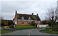
29 photos from this area
Area Information
Key information about the ST18 9NH including its size, population, and administrative classification.
- Area Type
- Postcode
- Area Size
- 26.4 hectares
- Population
- 2081
- Population Density
- 57 people/km²
House Prices in ST18 9NH
4
Properties
£245,000
Average Sold Price
£180,000
Lowest Price
£310,000
Highest Price
Showing 4 properties
| Address | Type | Beds | Baths | Last Sale Price | Last Sale Date | |
|---|---|---|---|---|---|---|
| Unit E Part 1, Boons Industrial Estate, Derrington Lane, Derrington, Stafford, ST18 9NH | undefined | - | - | £310,000 | Apr 2016 | |
| Unit E Part 4, Boons Industrial Estate, Derrington Lane, Derrington, Stafford, ST18 9NH | undefined | - | - | £180,000 | Aug 2001 | |
| Formally High Class Windows Limited, Boons Industrial Estate, Derrington Lane, Derrington, Stafford, ST18 9NH | warehouse | - | - | - | - | |
| Staffordshire Synthetic Stocks, Boons Industrial Estate, Derrington Lane, Derrington, Stafford, ST18 9NH | shop | - | - | - | - |
Energy Efficiency in ST18 9NH
Amenities
Schools
| Rank | School | Type | Entry gender | Ages |
|---|
Explore more schools in this area
Go to Schools tabDemographics
Household Size
Two person
most common
Accommodation Type
Houses
most common
Tenure
84
majority
Ethnic Group
White
most common
Religion
N/A
most common
Household Composition
N/A
most common
Age
47
median
Adults (30-64 years)
most common
Household Deprivation
N/A
with no deprivation
NS-SEC
42
in Lower managerial occupations
Explore more demographic insights in this area
Go to Demographics tabPlanning
Planning Constraints
- Flood RiskPremium
- Ramsar Wetland SitesPremium
- Area of Outstanding Natural BeautyPremium
- Protected Nature ReservePremium
- Protected WoodlandPremium