Area Overview for ST18 9LQ
Photos of ST18 9LQ

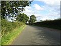
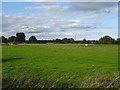
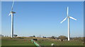

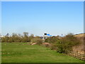

36 photos from this area
Area Information
Key information about the ST18 9LQ including its size, population, and administrative classification.
- Area Type
- Postcode
- Area Size
- 1.5 km²
- Population
- 2081
- Population Density
- 57 people/km²
House Prices in ST18 9LQ
11
Properties
£285,333
Average Sold Price
£136,000
Lowest Price
£375,000
Highest Price
Showing 11 properties
| Address | Type | Beds | Baths | Last Sale Price | Last Sale Date | |
|---|---|---|---|---|---|---|
| 2, Aston Cottages, Seighford Lane, Seighford, Stafford, ST18 9LQ | Semi-detached | 2 | - | £345,000 | Feb 2021 | |
| Fairview, Seighford Lane, Seighford, Stafford, ST18 9LQ | Semi-detached | 3 | 1 | £136,000 | Apr 2010 | |
| Linfield Care Services Ltd, Burley Heights, Seighford Lane, Seighford, Stafford, ST18 9LQ | Retirement | - | - | £375,000 | Aug 2007 | |
| West Point, Seighford Lane, Seighford, Stafford, ST18 9LQ | Bungalow | 4 | 2 | - | - | |
| 1, Aston Cottages, Seighford Lane, Seighford, Stafford, ST18 9LQ | Land | - | - | - | - | |
| Flat, Burley, Seighford Lane, Seighford, Stafford, ST18 9LQ | Cottage | 3 | 1 | - | - | |
| West Point Mews Ancillary Accommodation, Seighford Lane, Seighford, Stafford, ST18 9LQ | Detached | - | - | - | - | |
| Sunnyside, Seighford Lane, Seighford, Stafford, ST18 9LQ | house | 3 | - | - | - | |
| Visby, Seighford Lane, Seighford, Stafford, ST18 9LQ | Semi-detached | - | - | - | - | |
| Homelea, Seighford Lane, Seighford, Stafford, ST18 9LQ | Semi-detached | - | - | - | - |
Page 1 of 2
Energy Efficiency in ST18 9LQ
Amenities
Schools
| Rank | School | Type | Entry gender | Ages |
|---|
Explore more schools in this area
Go to Schools tabDemographics
Household Size
Two person
most common
Accommodation Type
Houses
most common
Tenure
84
majority
Ethnic Group
White
most common
Religion
N/A
most common
Household Composition
N/A
most common
Age
47
median
Adults (30-64 years)
most common
Household Deprivation
N/A
with no deprivation
NS-SEC
42
in Lower managerial occupations
Explore more demographic insights in this area
Go to Demographics tabPlanning
Planning Constraints
- Flood RiskPremium
- Ramsar Wetland SitesPremium
- Area of Outstanding Natural BeautyPremium
- Protected Nature ReservePremium
- Protected WoodlandPremium