Area Overview for ST18 9BQ
Photos of ST18 9BQ
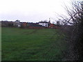

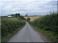
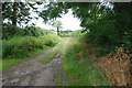

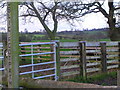
6 photos from this area
Area Information
Key information about the ST18 9BQ including its size, population, and administrative classification.
- Area Type
- Postcode
- Area Size
- 91.1 hectares
- Population
- 1781
- Population Density
- 57 people/km²
House Prices in ST18 9BQ
18
Properties
£278,930
Average Sold Price
£123,150
Lowest Price
£427,500
Highest Price
Showing 18 properties
| Address | Type | Beds | Baths | Last Sale Price | Last Sale Date | |
|---|---|---|---|---|---|---|
| Chailey, Bradley Lane, Hyde Lea, Stafford, ST18 9BQ | Detached | 4 | 1 | £427,500 | Apr 2023 | |
| Frog Crossing, Bradley Lane, Hyde Lea, Stafford, ST18 9BQ | house | - | - | £369,000 | Oct 2020 | |
| Autumn Rise, Bradley Lane, Hyde Lea, Stafford, ST18 9BQ | Detached | 4 | - | £310,000 | Oct 2017 | |
| Bradley Cottage, Bradley Lane, Hyde Lea, Stafford, ST18 9BQ | Detached | - | - | £165,000 | Jan 2002 | |
| Grand View, Bradley Lane, Hyde Lea, Stafford, ST18 9BQ | Detached | - | - | £123,150 | Mar 1997 | |
| Ashlea, Bradley Lane, Hyde Lea, Stafford, ST18 9BQ | Detached | 4 | 2 | - | - | |
| Alver, Bradley Lane, Hyde Lea, Stafford, ST18 9BQ | Detached | - | - | - | - | |
| Dalginross, Bradley Lane, Hyde Lea, Stafford, ST18 9BQ | Detached | - | - | - | - | |
| Holly House, Bradley Lane, Hyde Lea, Stafford, ST18 9BQ | Detached | - | - | - | - | |
| Tregaron, Bradley Lane, Hyde Lea, Stafford, ST18 9BQ | Detached | - | - | - | - |
Page 1 of 2
Energy Efficiency in ST18 9BQ
Amenities
Schools
| Rank | School | Type | Entry gender | Ages |
|---|
Explore more schools in this area
Go to Schools tabDemographics
Household Size
Two person
most common
Accommodation Type
Houses
most common
Tenure
81
majority
Ethnic Group
White
most common
Religion
N/A
most common
Household Composition
N/A
most common
Age
47
median
Adults (30-64 years)
most common
Household Deprivation
N/A
with no deprivation
NS-SEC
47
in Lower managerial occupations
Explore more demographic insights in this area
Go to Demographics tabPlanning
Planning Constraints
- Flood RiskPremium
- Ramsar Wetland SitesPremium
- Area of Outstanding Natural BeautyPremium
- Protected Nature ReservePremium
- Protected WoodlandPremium