Area Overview for ST18 9AH
Photos of ST18 9AH
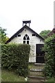
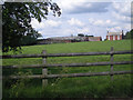
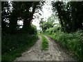
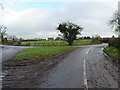
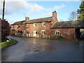
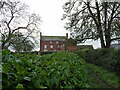

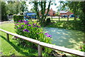
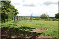
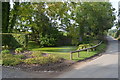
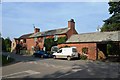
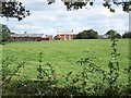
17 photos from this area
Area Information
Key information about the ST18 9AH including its size, population, and administrative classification.
- Area Type
- Postcode
- Area Size
- 3.3 km²
- Population
- 2164
- Population Density
- 114 people/km²
House Prices in ST18 9AH
45
Properties
£421,545
Average Sold Price
£143,000
Lowest Price
£760,000
Highest Price
Showing 45 properties
| Address | Type | Beds | Baths | Last Sale Price | Last Sale Date | |
|---|---|---|---|---|---|---|
| Hillcrest, Bradley Lane, Levedale, Stafford, ST18 9AH | Detached | - | - | £250,000 | Oct 2023 | |
| Levedale Cottage, Levedale Road, Levedale, ST18 9AH | Detached | 6 | 2 | £760,000 | Dec 2021 | |
| Levedale Farm, Levedale Road, Levedale, ST18 9AH | Land | - | - | £691,000 | Feb 2021 | |
| Eastlea, Levedale Road, Levedale, ST18 9AH | Bungalow | - | - | £363,000 | Dec 2019 | |
| Trinity Gate, Levedale Road, Levedale, ST18 9AH | Detached | 5 | 2 | £445,000 | Feb 2019 | |
| Knoll Cottage, Levedale Road, Levedale, ST18 9AH | Semi-detached | 3 | 2 | £375,000 | Feb 2018 | |
| Apple Tree Farm, Levedale Road, Levedale, ST18 9AH | Detached | 5 | 3 | £350,000 | Jul 2015 | |
| Oak Barns, Levedale Road, Levedale, ST18 9AH | Semi-detached | 5 | 4 | £300,000 | Jul 2015 | |
| Longridge Cottage, Levedale Road, Levedale, ST18 9AH | Detached | 7 | 5 | £620,000 | Mar 2015 | |
| Bank House Barn, Levedale Road, Levedale, ST18 9AH | Semi-detached | 3 | 2 | £340,000 | May 2013 |
Page 1 of 5
Energy Efficiency in ST18 9AH
Amenities
Schools
| Rank | School | Type | Entry gender | Ages |
|---|
Explore more schools in this area
Go to Schools tabDemographics
Household Size
Two person
most common
Accommodation Type
Houses
most common
Tenure
70
majority
Ethnic Group
White
most common
Religion
N/A
most common
Household Composition
N/A
most common
Age
47
median
Adults (30-64 years)
most common
Household Deprivation
N/A
with no deprivation
NS-SEC
34
in Lower managerial occupations
Explore more demographic insights in this area
Go to Demographics tabPlanning
Planning Constraints
- Flood RiskPremium
- Ramsar Wetland SitesPremium
- Area of Outstanding Natural BeautyPremium
- Protected Nature ReservePremium
- Protected WoodlandPremium