Area Overview for ST18 0XD
Photos of ST18 0XD

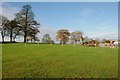


5 photos from this area
Area Information
Key information about the ST18 0XD including its size, population, and administrative classification.
- Area Type
- Postcode
- Area Size
- 1.6 km²
- Population
- 1534
- Population Density
- 59 people/km²
House Prices in ST18 0XD
22
Properties
£345,000
Average Sold Price
£100,000
Lowest Price
£590,000
Highest Price
Showing 22 properties
| Address | Type | Beds | Baths | Last Sale Price | Last Sale Date | |
|---|---|---|---|---|---|---|
| Bottom End Cottage, Bishton Lane, Wolseley Bridge, Stafford, ST18 0XD | house | 4 | 2 | £590,000 | Aug 2018 | |
| The Bungalow, Bishton Lane, Wolseley Bridge, Stafford, ST18 0XD | Bungalow | 2 | 1 | £100,000 | May 2003 | |
| Moreton Grange Farmhouse, Bishton Lane, Wolseley Bridge, Stafford, ST18 0XD | Semi-detached | 5 | 2 | - | - | |
| Snuggery Haven, Bishton Lane, Wolseley Bridge, Stafford, ST18 0XD | undefined | - | - | - | - | |
| The Barn, Moreton Grange, Bishton Lane, Wolseley Bridge, Stafford, ST18 0XD | house | 5 | - | - | - | |
| Moreton House Farmhouse, Bishton Lane, Wolseley Bridge, Stafford, ST18 0XD | Detached | - | - | - | - | |
| The Boskins, Moreton Grange, Bishton Lane, Wolseley Bridge, Stafford, ST18 0XD | house | - | - | - | - | |
| Rear Moreton Farm, Moreton Lane, Great Haywood, Stafford, ST18 0XD | undefined | - | - | - | - | |
| Moreton Farmhouse, Bishton Lane, Wolseley Bridge, Stafford, ST18 0XD | Detached | - | - | - | - | |
| Upper Moreton Farm, Bishton Lane, Wolseley Bridge, Stafford, ST18 0XD | community_day_centre | - | - | - | - |
Page 1 of 3
Energy Efficiency in ST18 0XD
Amenities
Schools
| Rank | School | Type | Entry gender | Ages |
|---|
Explore more schools in this area
Go to Schools tabDemographics
Household Size
Two person
most common
Accommodation Type
Houses
most common
Tenure
84
majority
Ethnic Group
White
most common
Religion
N/A
most common
Household Composition
N/A
most common
Age
47
median
Adults (30-64 years)
most common
Household Deprivation
N/A
with no deprivation
NS-SEC
47
in Lower managerial occupations
Explore more demographic insights in this area
Go to Demographics tabPlanning
Planning Constraints
- Flood RiskPremium
- Ramsar Wetland SitesPremium
- Area of Outstanding Natural BeautyPremium
- Protected Nature ReservePremium
- Protected WoodlandPremium