Area Overview for ST18 0JS
Photos of ST18 0JS


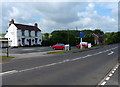
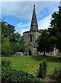
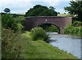
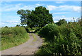
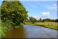
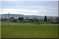
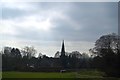
75 photos from this area
Area Information
Key information about the ST18 0JS including its size, population, and administrative classification.
- Area Type
- Postcode
- Area Size
- 1.5 km²
- Population
- 1970
- Population Density
- 51 people/km²
House Prices in ST18 0JS
23
Properties
£293,615
Average Sold Price
£175,000
Lowest Price
£490,000
Highest Price
Showing 23 properties
| Address | Type | Beds | Baths | Last Sale Price | Last Sale Date | |
|---|---|---|---|---|---|---|
| Sandonfields, London Road, Weston, Stafford, ST18 0JS | Bungalow | - | - | £280,000 | Jan 2025 | |
| Curlew River, London Road, Weston, Stafford, ST18 0JS | Detached | 4 | 2 | £300,000 | Jul 2023 | |
| Cherry Croft, London Road, Weston, Stafford, ST18 0JS | Bungalow | 5 | 3 | £200,000 | Aug 2019 | |
| Chartley, London Road, Weston, Stafford, ST18 0JS | Bungalow | 2 | 2 | £335,000 | Feb 2018 | |
| Toll House Farm, London Road, Weston, Stafford, ST18 0JS | house | 4 | - | £175,000 | Dec 2017 | |
| The Willows, London Road, Weston, Stafford, ST18 0JS | Detached | 4 | 3 | £490,000 | Apr 2017 | |
| Rylands, London Road, Weston, Stafford, ST18 0JS | Bungalow | 2 | 1 | £245,000 | Aug 2016 | |
| Westowe, London Road, Weston, Stafford, ST18 0JS | Bungalow | 3 | 1 | £335,000 | Jul 2015 | |
| Rose Cottage, London Road, Weston, Stafford, ST18 0JS | Detached | 3 | - | £180,000 | Mar 2015 | |
| Bridge House, London Road, Shirleywich, Stafford, ST18 0JS | Detached | 5 | - | £465,000 | Jan 2014 |
Page 1 of 3
Energy Efficiency in ST18 0JS
Amenities
Schools
| Rank | School | Type | Entry gender | Ages |
|---|
Explore more schools in this area
Go to Schools tabDemographics
Household Size
Two person
most common
Accommodation Type
Houses
most common
Tenure
83
majority
Ethnic Group
White
most common
Religion
N/A
most common
Household Composition
N/A
most common
Age
47
median
Adults (30-64 years)
most common
Household Deprivation
N/A
with no deprivation
NS-SEC
45
in Lower managerial occupations
Explore more demographic insights in this area
Go to Demographics tabPlanning
Planning Constraints
- Flood RiskPremium
- Ramsar Wetland SitesPremium
- Area of Outstanding Natural BeautyPremium
- Protected Nature ReservePremium
- Protected WoodlandPremium