Area Overview for ST18 0EZ
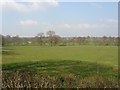
Photos of ST18 0EZ
![Unseen district boundary on the B5027 [Uttoxeter Road] in ST18 0EZ](https://images.propbar.co.uk/images/geograph/66/76/6676276_120.jpg)
7 photos from this area
Area Information
Key information about the ST18 0EZ including its size, population, and administrative classification.
- Area Type
- Postcode
- Area Size
- 2.2 km²
- Population
- 1277
- Population Density
- 30 people/km²
House Prices in ST18 0EZ
7
Properties
£110,000
Average Sold Price
£110,000
Lowest Price
£110,000
Highest Price
Showing 7 properties
| Address | Type | Beds | Baths | Last Sale Price | Last Sale Date | |
|---|---|---|---|---|---|---|
| Lower Birchwood Park Farm, Birchwood Park, Fradswell, ST18 0EZ | Detached | - | - | £110,000 | May 1995 | |
| Birchwood Cottage, Birchwood Park, Fradswell, ST18 0EZ | Detached | - | - | - | - | |
| Horse Chestnut Farm, Birchwood Park, Fradswell, ST18 0EZ | house | - | - | - | - | |
| Bramble Cottage, Birchwood Park, Fradswell, ST18 0EZ | Detached | - | - | - | - | |
| Birchwood Park Farm, Birchwood Park, Fradswell, ST18 0EZ | house | - | - | - | - | |
| New House Farm, Birchwood Park, Fradswell, ST18 0EZ | Detached | - | - | - | - | |
| The Standings, Birchwood Park, Fradswell, ST18 0EZ | Semi-detached | - | - | - | - |
Energy Efficiency in ST18 0EZ
Amenities
Schools
| Rank | School | Type | Entry gender | Ages |
|---|
Explore more schools in this area
Go to Schools tabDemographics
Household Size
Two person
most common
Accommodation Type
Houses
most common
Tenure
87
majority
Ethnic Group
White
most common
Religion
N/A
most common
Household Composition
N/A
most common
Age
47
median
Adults (30-64 years)
most common
Household Deprivation
N/A
with no deprivation
NS-SEC
37
in Lower managerial occupations
Explore more demographic insights in this area
Go to Demographics tabPlanning
Planning Constraints
- Flood RiskPremium
- Ramsar Wetland SitesPremium
- Area of Outstanding Natural BeautyPremium
- Protected Nature ReservePremium
- Protected WoodlandPremium