Area Overview for ST17 4HG
Photos of ST17 4HG
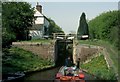
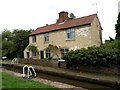
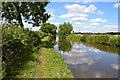
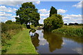
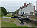
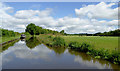
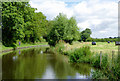
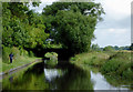

83 photos from this area
Area Information
Key information about the ST17 4HG including its size, population, and administrative classification.
- Area Type
- Postcode
- Area Size
- 16.5 hectares
- Population
- 2202
- Population Density
- 1338 people/km²
House Prices in ST17 4HG
19
Properties
£232,313
Average Sold Price
£65,000
Lowest Price
£450,000
Highest Price
Showing 19 properties
| Address | Type | Beds | Baths | Last Sale Price | Last Sale Date | |
|---|---|---|---|---|---|---|
| The Conifers, 1B Old Rickerscote Lane, Stafford, ST17 4HG | Flat | - | - | £65,000 | Jun 2025 | |
| The Hollies, Old Rickerscote Lane, Stafford, ST17 4HG | house | 3 | - | £450,000 | May 2021 | |
| Ivy Cottage, Old Rickerscote Lane, Stafford, ST17 4HG | Semi-detached | 4 | 1 | £307,500 | Sep 2018 | |
| Brook Cottage, Old Rickerscote Lane, Stafford, ST17 4HG | Detached | 4 | 2 | £365,000 | Oct 2010 | |
| Ivydene, Old Rickerscote Lane, Stafford, ST17 4HG | Terraced | 3 | 1 | £145,000 | Sep 2006 | |
| Fieldview, Old Rickerscote Lane, Stafford, ST17 4HG | Bungalow | - | - | £108,000 | Jun 2006 | |
| Clifton Cottage, Old Rickerscote Lane, Stafford, ST17 4HG | Detached | - | - | £175,000 | Feb 2006 | |
| The Willows, Old Rickerscote Lane, Stafford, ST17 4HG | Detached | - | - | £243,000 | Oct 2002 | |
| 1A Old Rickerscote Lane, Stafford, ST17 4HG | Flat | 3 | 1 | - | - | |
| 2, Pear Tree Cottages, Old Rickerscote Lane, Stafford, ST17 4HG | Semi-detached | 3 | 1 | - | - |
Page 1 of 2
Energy Efficiency in ST17 4HG
Amenities
Schools
| Rank | School | Type | Entry gender | Ages |
|---|
Explore more schools in this area
Go to Schools tabDemographics
Household Size
Two person
most common
Accommodation Type
Houses
most common
Tenure
71
majority
Ethnic Group
White
most common
Religion
N/A
most common
Household Composition
N/A
most common
Age
47
median
Adults (30-64 years)
most common
Household Deprivation
N/A
with no deprivation
NS-SEC
33
in Lower managerial occupations
Explore more demographic insights in this area
Go to Demographics tabPlanning
Planning Constraints
- Flood RiskPremium
- Ramsar Wetland SitesPremium
- Area of Outstanding Natural BeautyPremium
- Protected Nature ReservePremium
- Protected WoodlandPremium