Area Overview for ST17 0XQ
Photos of ST17 0XQ
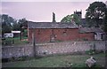

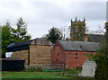
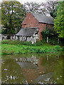
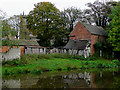

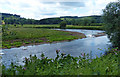
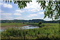
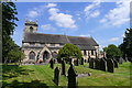
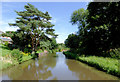
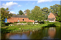
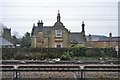
64 photos from this area
Area Information
Key information about the ST17 0XQ including its size, population, and administrative classification.
- Area Type
- Postcode
- Area Size
- 15.8 hectares
- Population
- 1534
- Population Density
- 59 people/km²
House Prices in ST17 0XQ
12
Properties
£242,750
Average Sold Price
£50,000
Lowest Price
£650,000
Highest Price
Showing 12 properties
| Address | Type | Beds | Baths | Last Sale Price | Last Sale Date | |
|---|---|---|---|---|---|---|
| 1, Wolseley Villas, Main Road, Colwich, Stafford, ST17 0XQ | house | - | - | £260,000 | Aug 2021 | |
| 3, Wolseley Villas, Main Road, Colwich, Stafford, ST17 0XQ | house | - | - | £235,000 | Sep 2019 | |
| The Gables, Main Road, Colwich, Stafford, ST17 0XQ | house | - | - | £650,000 | Jan 2017 | |
| 4, Wolseley Villas, Main Road, Colwich, Stafford, ST17 0XQ | house | - | - | £175,000 | Apr 2013 | |
| Gleehaven Cottage, Main Road, Colwich, Stafford, ST17 0XQ | Detached | - | - | £250,000 | Aug 2004 | |
| Hilcot, Main Road, Colwich, Stafford, ST17 0XQ | house | - | - | £195,000 | Jun 2001 | |
| Hambleton, Main Road, Colwich, Stafford, ST17 0XQ | Detached | - | - | £127,000 | Dec 1997 | |
| Kildonan, Main Road, Colwich, Stafford, ST17 0XQ | Detached | - | - | £50,000 | Mar 1997 | |
| Ash Ling, Main Road, Colwich, Stafford, ST17 0XQ | Detached | 5 | 3 | - | - | |
| 2, Wolseley Villas, Main Road, Colwich, Stafford, ST17 0XQ | Terraced | - | - | - | - |
Page 1 of 2
Energy Efficiency in ST17 0XQ
Amenities
Schools
| Rank | School | Type | Entry gender | Ages |
|---|
Explore more schools in this area
Go to Schools tabDemographics
Household Size
Two person
most common
Accommodation Type
Houses
most common
Tenure
84
majority
Ethnic Group
White
most common
Religion
N/A
most common
Household Composition
N/A
most common
Age
47
median
Adults (30-64 years)
most common
Household Deprivation
N/A
with no deprivation
NS-SEC
47
in Lower managerial occupations
Explore more demographic insights in this area
Go to Demographics tabPlanning
Planning Constraints
- Flood RiskPremium
- Ramsar Wetland SitesPremium
- Area of Outstanding Natural BeautyPremium
- Protected Nature ReservePremium
- Protected WoodlandPremium