Area Overview for ST17 0UN
Photos of ST17 0UN


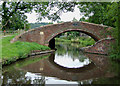


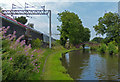
100 photos from this area
Area Information
Key information about the ST17 0UN including its size, population, and administrative classification.
- Area Type
- Postcode
- Area Size
- 14.9 hectares
- Population
- 2614
- Population Density
- 225 people/km²
House Prices in ST17 0UN
22
Properties
£325,357
Average Sold Price
£215,000
Lowest Price
£620,000
Highest Price
Showing 22 properties
| Address | Type | Beds | Baths | Last Sale Price | Last Sale Date | |
|---|---|---|---|---|---|---|
| 190 Main Road, Milford, Stafford, ST17 0UN | Cottage | 3 | 2 | £237,500 | Aug 2020 | |
| Sundorne House, 196 Main Road, Milford, Stafford, ST17 0UN | house | 4 | - | £395,000 | Oct 2018 | |
| 186 Main Road, Milford, Stafford, ST17 0UN | Terraced | 3 | 2 | £250,000 | Feb 2018 | |
| Pear Tree Cottage, 184A Main Road, Milford, Stafford, ST17 0UN | Detached | 3 | 2 | £320,000 | Jun 2017 | |
| The Paddock, 182 Main Road, Milford, Stafford, ST17 0UN | Semi-detached | 3 | - | £620,000 | Oct 2016 | |
| 188 Main Road, Milford, Stafford, ST17 0UN | Cottage | 3 | 1 | £240,000 | May 2015 | |
| Wyevern, 198 Main Road, Milford, Stafford, ST17 0UN | Detached | 3 | 1 | £215,000 | Dec 2002 | |
| 184 Main Road, Milford, Stafford, ST17 0UN | Detached | 3 | - | - | - | |
| 196A Main Road, Milford, Stafford, ST17 0UN | Detached | 5 | - | - | - | |
| The Paddock, Main Road, Milford, Stafford, ST17 0UN | undefined | - | - | - | - |
Page 1 of 3
Energy Efficiency in ST17 0UN
Amenities
Schools
| Rank | School | Type | Entry gender | Ages |
|---|
Explore more schools in this area
Go to Schools tabDemographics
Household Size
Two person
most common
Accommodation Type
Houses
most common
Tenure
90
majority
Ethnic Group
White
most common
Religion
N/A
most common
Household Composition
N/A
most common
Age
47
median
Adults (30-64 years)
most common
Household Deprivation
N/A
with no deprivation
NS-SEC
53
in Lower managerial occupations
Explore more demographic insights in this area
Go to Demographics tabPlanning
Planning Constraints
- Flood RiskPremium
- Ramsar Wetland SitesPremium
- Area of Outstanding Natural BeautyPremium
- Protected Nature ReservePremium
- Protected WoodlandPremium