Area Overview for ST17 0ST
Photos of ST17 0ST
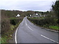
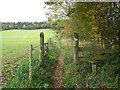
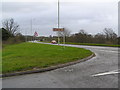
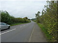
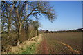
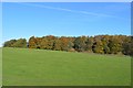
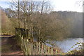
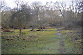
13 photos from this area
Area Information
Key information about the ST17 0ST including its size, population, and administrative classification.
- Area Type
- Postcode
- Area Size
- 19.9 hectares
- Population
- 2614
- Population Density
- 225 people/km²
House Prices in ST17 0ST
18
Properties
£237,742
Average Sold Price
£71,000
Lowest Price
£375,000
Highest Price
Showing 18 properties
| Address | Type | Beds | Baths | Last Sale Price | Last Sale Date | |
|---|---|---|---|---|---|---|
| 10 Cannock Road, Brocton, Stafford, ST17 0ST | Semi-detached | 3 | 2 | £370,000 | Dec 2023 | |
| 1 Cannock Road, Brocton, Stafford, ST17 0ST | Semi-detached | 3 | - | £375,000 | Nov 2022 | |
| 3 Cannock Road, Brocton, Stafford, ST17 0ST | Detached | 4 | 4 | £325,000 | Dec 2019 | |
| 7 Cannock Road, Brocton, Stafford, ST17 0ST | Semi-detached | - | - | £155,500 | Oct 2003 | |
| 2 Cannock Road, Brocton, Stafford, ST17 0ST | house | - | - | £129,950 | Mar 2003 | |
| Ashdown, Cannock Road, Brocton, Stafford, ST17 0ST | Semi-detached | - | - | £71,000 | Aug 1999 | |
| Managers Accommodation, Chetwynd Arms, Cannock Road, Brocton, Stafford, ST17 0ST | Flat | - | - | - | - | |
| 4 Cannock Road, Brocton, Stafford, ST17 0ST | house | - | - | - | - | |
| Fairbourne, Cannock Road, Brocton, Stafford, ST17 0ST | Detached | - | - | - | - | |
| 9 Cannock Road, Brocton, Stafford, ST17 0ST | Semi-detached | - | - | - | - |
Page 1 of 2
Energy Efficiency in ST17 0ST
Amenities
Schools
| Rank | School | Type | Entry gender | Ages |
|---|
Explore more schools in this area
Go to Schools tabDemographics
Household Size
Two person
most common
Accommodation Type
Houses
most common
Tenure
90
majority
Ethnic Group
White
most common
Religion
N/A
most common
Household Composition
N/A
most common
Age
47
median
Adults (30-64 years)
most common
Household Deprivation
N/A
with no deprivation
NS-SEC
53
in Lower managerial occupations
Explore more demographic insights in this area
Go to Demographics tabPlanning
Planning Constraints
- Flood RiskPremium
- Ramsar Wetland SitesPremium
- Area of Outstanding Natural BeautyPremium
- Protected Nature ReservePremium
- Protected WoodlandPremium