Area Overview for ST16 3NU
Photos of ST16 3NU
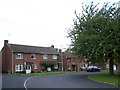
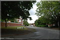
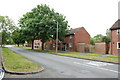
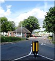
13 photos from this area
Area Information
Key information about the ST16 3NU including its size, population, and administrative classification.
- Area Type
- Postcode
- Area Size
- 6943 m²
- Population
- 1466
- Population Density
- 5760 people/km²
House Prices in ST16 3NU
14
Properties
£108,700
Average Sold Price
£65,000
Lowest Price
£165,000
Highest Price
Showing 14 properties
| Address | Type | Beds | Baths | Last Sale Price | Last Sale Date | |
|---|---|---|---|---|---|---|
| 8 Shelley Close, Stafford, ST16 3NU | Terraced | 3 | 1 | £165,000 | Feb 2023 | |
| 3A Shelley Close, Stafford, ST16 3NU | Flat | 3 | 1 | £75,000 | Feb 2018 | |
| 3B Shelley Close, Stafford, ST16 3NU | Flat | - | - | £75,000 | Feb 2018 | |
| 12 Shelley Close, Stafford, ST16 3NU | house | 3 | 1 | £134,500 | Oct 2016 | |
| 3 Shelley Close, Stafford, ST16 3NU | Semi-detached | 3 | 1 | £124,500 | Dec 2010 | |
| 1 Shelley Close, Stafford, ST16 3NU | Flat | 2 | 1 | £105,000 | Jul 2009 | |
| 11 Shelley Close, Stafford, ST16 3NU | Semi-detached | 3 | - | £120,000 | Aug 2008 | |
| 6 Shelley Close, Stafford, ST16 3NU | Terraced | - | - | £65,000 | Aug 2006 | |
| 7 Shelley Close, Stafford, ST16 3NU | house | 4 | - | £118,000 | Feb 2006 | |
| 5 Shelley Close, Stafford, ST16 3NU | house | - | - | £105,000 | Mar 2005 |
Page 1 of 2
Energy Efficiency in ST16 3NU
Amenities
Schools
| Rank | School | Type | Entry gender | Ages |
|---|
Explore more schools in this area
Go to Schools tabDemographics
Household Size
Family (3-5 people)
most common
Accommodation Type
Houses
most common
Tenure
22
majority
Ethnic Group
White
most common
Religion
N/A
most common
Household Composition
N/A
most common
Age
22
median
Adults (30-64 years)
most common
Household Deprivation
N/A
with no deprivation
NS-SEC
31
in Lower managerial occupations
Explore more demographic insights in this area
Go to Demographics tabPlanning
Planning Constraints
- Flood RiskPremium
- Ramsar Wetland SitesPremium
- Area of Outstanding Natural BeautyPremium
- Protected Nature ReservePremium
- Protected WoodlandPremium