Area Overview for ST16 1ZY
Photos of ST16 1ZY
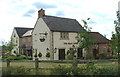


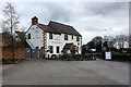

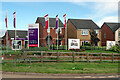
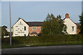
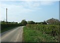
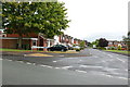
24 photos from this area
Area Information
Key information about the ST16 1ZY including its size, population, and administrative classification.
- Area Type
- Postcode
- Area Size
- 12.7 hectares
- Population
- 2499
- Population Density
- 120 people/km²
House Prices in ST16 1ZY
92
Properties
£242,240
Average Sold Price
£210,900
Lowest Price
£256,500
Highest Price
Showing 92 properties
| Address | Type | Beds | Baths | Last Sale Price | Last Sale Date | |
|---|---|---|---|---|---|---|
| 34 Ramson Avenue, Stafford, ST16 1ZY | house | - | - | £248,750 | Apr 2025 | |
| 32 Ramson Avenue, Stafford, ST16 1ZY | house | - | - | £256,500 | Mar 2025 | |
| 55 Ramson Avenue, Stafford, ST16 1ZY | house | - | - | £210,900 | Mar 2025 | |
| 30 Ramson Avenue, Stafford, ST16 1ZY | house | - | - | £246,050 | Feb 2025 | |
| 28 Ramson Avenue, Stafford, ST16 1ZY | house | - | - | £249,000 | Jan 2025 | |
| 16 Ramson Avenue, Stafford, ST16 1ZY | Detached | 4 | 2 | - | - | |
| 59 Woodruff Chase, Stafford, ST16 1ZY | Detached | - | - | - | - | |
| 37 Ramson Avenue, Stafford, ST16 1ZY | Detached | - | - | - | - | |
| 39 Ramson Avenue, Stafford, ST16 1ZY | Detached | - | - | - | - | |
| 35 Ramson Avenue, Stafford, ST16 1ZY | Detached | - | - | - | - |
Page 1 of 10
Energy Efficiency in ST16 1ZY
Amenities
Schools
| Rank | School | Type | Entry gender | Ages |
|---|
Explore more schools in this area
Go to Schools tabDemographics
Household Size
Two person
most common
Accommodation Type
Houses
most common
Tenure
88
majority
Ethnic Group
White
most common
Religion
N/A
most common
Household Composition
N/A
most common
Age
47
median
Adults (30-64 years)
most common
Household Deprivation
N/A
with no deprivation
NS-SEC
45
in Lower managerial occupations
Explore more demographic insights in this area
Go to Demographics tabPlanning
Planning Constraints
- Flood RiskPremium
- Ramsar Wetland SitesPremium
- Area of Outstanding Natural BeautyPremium
- Protected Nature ReservePremium
- Protected WoodlandPremium