Area Overview for ST16 1DA
Photos of ST16 1DA


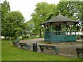

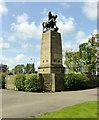

100 photos from this area
Area Information
Key information about the ST16 1DA including its size, population, and administrative classification.
- Area Type
- Postcode
- Area Size
- 2.1 hectares
- Population
- 1738
- Population Density
- 2323 people/km²
House Prices in ST16 1DA
43
Properties
£311,667
Average Sold Price
£72,000
Lowest Price
£573,000
Highest Price
Showing 43 properties
| Address | Type | Beds | Baths | Last Sale Price | Last Sale Date | |
|---|---|---|---|---|---|---|
| 45 Newport Road, Stafford, ST16 1DA | Terraced | 5 | 2 | £286,000 | Jun 2021 | |
| Copthorne, Newport Road, Stafford, ST16 1DA | Semi-detached | 3 | 2 | £280,000 | Jun 2021 | |
| 53 Newport Road, Stafford, ST16 1DA | Detached | 5 | 2 | £573,000 | Feb 2021 | |
| 60 Newport Road, Stafford, ST16 1DA | Semi-detached | 6 | 2 | £570,000 | Aug 2020 | |
| 114 Newport Road, Stafford, ST16 1DA | Detached | 5 | 3 | £570,000 | Dec 2018 | |
| 61 Newport Road, Stafford, ST16 1DA | Semi-detached | 4 | 1 | £275,000 | Sep 2017 | |
| Thistle Dew, Newport Road, Stafford, ST16 1DA | Detached | - | - | £450,000 | Jun 2016 | |
| 46 Newport Road, Stafford, ST16 1DA | Terraced | 5 | 2 | £204,000 | Aug 2015 | |
| 44 Newport Road, Stafford, ST16 1DA | Terraced | 6 | - | £245,000 | Nov 2007 | |
| 51 Newport Road, Stafford, ST16 1DA | Semi-detached | - | - | £260,000 | Oct 2007 |
Page 1 of 5
Energy Efficiency in ST16 1DA
Amenities
Schools
| Rank | School | Type | Entry gender | Ages |
|---|
Explore more schools in this area
Go to Schools tabDemographics
Household Size
Two person
most common
Accommodation Type
Houses
most common
Tenure
71
majority
Ethnic Group
White
most common
Religion
N/A
most common
Household Composition
N/A
most common
Age
47
median
Adults (30-64 years)
most common
Household Deprivation
N/A
with no deprivation
NS-SEC
42
in Lower managerial occupations
Explore more demographic insights in this area
Go to Demographics tabPlanning
Planning Constraints
- Flood RiskPremium
- Ramsar Wetland SitesPremium
- Area of Outstanding Natural BeautyPremium
- Protected Nature ReservePremium
- Protected WoodlandPremium