Area Overview for ST15 8RL
Photos of ST15 8RL
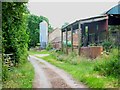

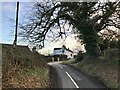
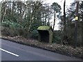
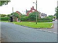
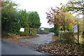
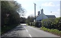
7 photos from this area
Area Information
Key information about the ST15 8RL including its size, population, and administrative classification.
- Area Type
- Postcode
- Area Size
- 36.3 hectares
- Population
- 1623
- Population Density
- 175 people/km²
House Prices in ST15 8RL
17
Properties
£433,750
Average Sold Price
£175,000
Lowest Price
£800,000
Highest Price
Showing 17 properties
| Address | Type | Beds | Baths | Last Sale Price | Last Sale Date | |
|---|---|---|---|---|---|---|
| Cross Gate Cottage, Moss Lane, Moss Gate, Stone, ST15 8RL | Detached | - | - | £800,000 | May 2024 | |
| The Hollies, Fulford Road, Crossgate, Stone, ST15 8RL | Equestrian | 3 | 3 | £570,000 | Dec 2018 | |
| Yew Tree Cottage, Sandy Lane, Cross Gate, Stone, ST15 8RL | house | 3 | 1 | £190,000 | May 2015 | |
| Little Fields, Fulford Road, Crossgate, Stone, ST15 8RL | house | - | - | £175,000 | Dec 2001 | |
| The Firs, Fulford Road, Crossgate, Stone, ST15 8RL | Cottage | 3 | 1 | - | - | |
| The Cottage, Sandy Lane, Cross Gate, Stone, ST15 8RL | Cottage | 3 | 2 | - | - | |
| Oak House, Fulford Road, Crossgate, Stone, ST15 8RL | Detached | 5 | 2 | - | - | |
| The Cottage, Cleaver, Sandy Lane, Cross Gate, Stone, ST15 8RL | undefined | - | - | - | - | |
| Crossfields, Fulford Road, Fulford, Stoke On Trent, ST15 8RL | undefined | - | - | - | - | |
| Cleaver, Sandy Lane, Cross Gate, Stone, ST15 8RL | undefined | - | - | - | - |
Page 1 of 2
Energy Efficiency in ST15 8RL
Amenities
Schools
| Rank | School | Type | Entry gender | Ages |
|---|
Explore more schools in this area
Go to Schools tabDemographics
Household Size
Two person
most common
Accommodation Type
Houses
most common
Tenure
83
majority
Ethnic Group
White
most common
Religion
N/A
most common
Household Composition
N/A
most common
Age
47
median
Adults (30-64 years)
most common
Household Deprivation
N/A
with no deprivation
NS-SEC
44
in Lower managerial occupations
Explore more demographic insights in this area
Go to Demographics tabPlanning
Planning Constraints
- Flood RiskPremium
- Ramsar Wetland SitesPremium
- Area of Outstanding Natural BeautyPremium
- Protected Nature ReservePremium
- Protected WoodlandPremium