Area Overview for ST15 8RD
Photos of ST15 8RD

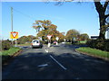
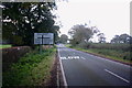
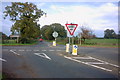
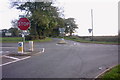

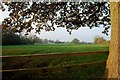
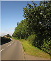
14 photos from this area
Area Information
Key information about the ST15 8RD including its size, population, and administrative classification.
- Area Type
- Postcode
- Area Size
- 58.5 hectares
- Population
- 1919
- Population Density
- 36 people/km²
House Prices in ST15 8RD
12
Properties
£606,250
Average Sold Price
£497,500
Lowest Price
£715,000
Highest Price
Showing 12 properties
| Address | Type | Beds | Baths | Last Sale Price | Last Sale Date | |
|---|---|---|---|---|---|---|
| The Cottage, Whitesytch Lane, Hilderstone, Stone, ST15 8RD | Detached | 4 | 1 | £715,000 | Jul 2023 | |
| Whitesytch House, Whitesytch Lane, Hilderstone, Stone, ST15 8RD | Detached | 4 | 2 | £497,500 | Jun 2006 | |
| Lea House, Whitesytch Lane, Hilderstone, Stone, ST15 8RD | Detached | 3 | 2 | - | - | |
| Neville Farm, Whitesytch Lane, Hilderstone, Stone, ST15 8RD | Detached | 3 | 1 | - | - | |
| Caravan, Black Birch Farm, Whitesytch Lane, Hilderstone, Stone, ST15 8RD | Mobile Home | - | - | - | - | |
| Nordiz Style Log Cabin, Whitesytch Nursery, Whitesytch Lane, Hilderstone, Stone, ST15 8RD | Detached | - | - | - | - | |
| Lazy Days Cattery, Neville Farm, Whitesytch Lane, Hilderstone, Stone, ST15 8RD | commercial | - | - | - | - | |
| Whitesytch Farm, Whitesytch Lane, Hilderstone, Stone, ST15 8RD | house | - | - | - | - | |
| Black Birch Farm, Whitesytch Lane, Hilderstone, Stone, ST15 8RD | Detached | - | - | - | - | |
| Peakshill Farm, Whitesytch Lane, Hilderstone, Stone, ST15 8RD | Terraced | - | - | - | - |
Page 1 of 2
Energy Efficiency in ST15 8RD
Amenities
Schools
| Rank | School | Type | Entry gender | Ages |
|---|
Explore more schools in this area
Go to Schools tabDemographics
Household Size
Two person
most common
Accommodation Type
Houses
most common
Tenure
76
majority
Ethnic Group
White
most common
Religion
N/A
most common
Household Composition
N/A
most common
Age
47
median
Adults (30-64 years)
most common
Household Deprivation
N/A
with no deprivation
NS-SEC
42
in Lower managerial occupations
Explore more demographic insights in this area
Go to Demographics tabPlanning
Planning Constraints
- Flood RiskPremium
- Ramsar Wetland SitesPremium
- Area of Outstanding Natural BeautyPremium
- Protected Nature ReservePremium
- Protected WoodlandPremium