Area Overview for ST15 8PA
Photos of ST15 8PA
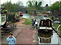
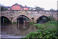
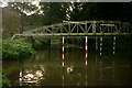
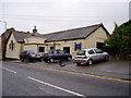

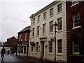
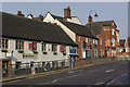
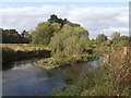
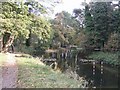
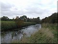
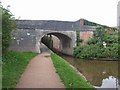
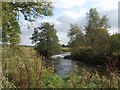
100 photos from this area
Area Information
Key information about the ST15 8PA including its size, population, and administrative classification.
- Area Type
- Postcode
- Area Size
- 6687 m²
- Population
- 1721
- Population Density
- 1456 people/km²
House Prices in ST15 8PA
31
Properties
£125,000
Average Sold Price
£105,000
Lowest Price
£137,000
Highest Price
Showing 31 properties
| Address | Type | Beds | Baths | Last Sale Price | Last Sale Date | |
|---|---|---|---|---|---|---|
| 10, Kenilworth Court, Abbey Street, Stone, ST15 8PA | Flat | - | - | £137,000 | May 2025 | |
| 4, Kenilworth Court, Abbey Street, Stone, ST15 8PA | Flat | 2 | 1 | £128,000 | Feb 2025 | |
| 6, Kenilworth Court, Abbey Street, Stone, ST15 8PA | Flat | 2 | 2 | £129,000 | Aug 2022 | |
| 11, Kenilworth Court, Abbey Street, Stone, ST15 8PA | Flat | 2 | 2 | £126,000 | Jun 2021 | |
| 12, Kenilworth Court, Abbey Street, Stone, ST15 8PA | Flat | - | - | £105,000 | Sep 2016 | |
| 3, Kenilworth Court, Abbey Street, Stone, ST15 8PA | Flat | 2 | 2 | - | - | |
| 8, Kenilworth Court, Abbey Street, Stone, ST15 8PA | Flat | 1 | 1 | - | - | |
| 5, Kenilworth Court, Abbey Street, Stone, ST15 8PA | Flat | 2 | 2 | - | - | |
| Squirrels Drey, March Hare House, 21-23 Abbey Street, Stone, ST15 8PA | Flat | - | - | - | - | |
| Foxes Earth, March Hare House, 21-23 Abbey Street, Stone, ST15 8PA | Flat | - | - | - | - |
Page 1 of 4
Energy Efficiency in ST15 8PA
Amenities
Schools
| Rank | School | Type | Entry gender | Ages |
|---|
Explore more schools in this area
Go to Schools tabDemographics
Household Size
One person
most common
Accommodation Type
Houses
most common
Tenure
48
majority
Ethnic Group
White
most common
Religion
N/A
most common
Household Composition
N/A
most common
Age
47
median
Adults (30-64 years)
most common
Household Deprivation
N/A
with no deprivation
NS-SEC
33
in Lower managerial occupations
Explore more demographic insights in this area
Go to Demographics tabPlanning
Planning Constraints
- Flood RiskPremium
- Ramsar Wetland SitesPremium
- Area of Outstanding Natural BeautyPremium
- Protected Nature ReservePremium
- Protected WoodlandPremium