Area Overview for ST15 8HU
Photos of ST15 8HU

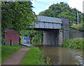
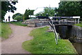
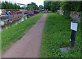
100 photos from this area
Area Information
Key information about the ST15 8HU including its size, population, and administrative classification.
- Area Type
- Postcode
- Area Size
- 4.4 hectares
- Population
- 2413
- Population Density
- 2785 people/km²
House Prices in ST15 8HU
37
Properties
£208,115
Average Sold Price
£58,000
Lowest Price
£411,000
Highest Price
Showing 37 properties
| Address | Type | Beds | Baths | Last Sale Price | Last Sale Date | |
|---|---|---|---|---|---|---|
| 30 Mount Avenue, Stone, ST15 8HU | Bungalow | 3 | 2 | £411,000 | Jul 2023 | |
| 35 Mount Avenue, Stone, ST15 8HU | Bungalow | 2 | 2 | £390,000 | Jul 2023 | |
| 10 Mount Avenue, Stone, ST15 8HU | Bungalow | 3 | 1 | £203,000 | Aug 2019 | |
| 1 Mount Avenue, Stone, ST15 8HU | Semi-detached | 3 | 2 | £220,000 | Aug 2018 | |
| 33 Mount Avenue, Stone, ST15 8HU | Bungalow | 3 | 1 | £305,000 | Jan 2017 | |
| 2 Mount Avenue, Stone, ST15 8HU | Semi-detached | 2 | 1 | £157,000 | Oct 2016 | |
| 34 Mount Avenue, Stone, ST15 8HU | Bungalow | 2 | 1 | £193,000 | Sep 2016 | |
| 27 Mount Avenue, Stone, ST15 8HU | Bungalow | 3 | 1 | £292,500 | Sep 2016 | |
| 6 Mount Avenue, Stone, ST15 8HU | Semi-detached | 2 | 1 | £146,000 | Nov 2014 | |
| 36 Mount Avenue, Stone, ST15 8HU | Bungalow | 2 | 1 | £214,500 | Oct 2014 |
Page 1 of 4
Energy Efficiency in ST15 8HU
Amenities
Schools
| Rank | School | Type | Entry gender | Ages |
|---|
Explore more schools in this area
Go to Schools tabDemographics
Household Size
Two person
most common
Accommodation Type
Houses
most common
Tenure
74
majority
Ethnic Group
White
most common
Religion
N/A
most common
Household Composition
N/A
most common
Age
47
median
Adults (30-64 years)
most common
Household Deprivation
N/A
with no deprivation
NS-SEC
47
in Lower managerial occupations
Explore more demographic insights in this area
Go to Demographics tabPlanning
Planning Constraints
- Flood RiskPremium
- Ramsar Wetland SitesPremium
- Area of Outstanding Natural BeautyPremium
- Protected Nature ReservePremium
- Protected WoodlandPremium