Area Overview for ST15 8EX
Photos of ST15 8EX
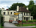
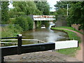
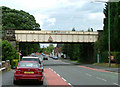


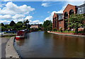
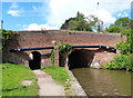


100 photos from this area
Area Information
Key information about the ST15 8EX including its size, population, and administrative classification.
- Area Type
- Postcode
- Area Size
- 4582 m²
- Population
- 2413
- Population Density
- 2785 people/km²
House Prices in ST15 8EX
18
Properties
£115,670
Average Sold Price
£37,000
Lowest Price
£154,000
Highest Price
Showing 18 properties
| Address | Type | Beds | Baths | Last Sale Price | Last Sale Date | |
|---|---|---|---|---|---|---|
| 16 Alma Street, Stone, ST15 8EX | Terraced | 2 | 1 | £142,000 | Dec 2025 | |
| 2 Alma Street, Stone, ST15 8EX | Terraced | 2 | 1 | £145,025 | Jul 2023 | |
| 7 Alma Street, Stone, ST15 8EX | house | 3 | 1 | £154,000 | Sep 2017 | |
| 13 Alma Street, Stone, ST15 8EX | Terraced | 2 | - | £134,950 | May 2014 | |
| 9 Alma Street, Stone, ST15 8EX | house | - | - | £136,950 | Nov 2012 | |
| 10 Alma Street, Stone, ST15 8EX | Terraced | 2 | 1 | £105,000 | Mar 2011 | |
| 6 Alma Street, Stone, ST15 8EX | house | - | - | £120,000 | Feb 2009 | |
| 3 Alma Street, Stone, ST15 8EX | Terraced | 2 | 1 | £116,000 | Feb 2008 | |
| 5 Alma Street, Stone, ST15 8EX | house | 2 | 1 | £116,500 | Apr 2006 | |
| 18 Alma Street, Stone, ST15 8EX | Terraced | 2 | - | £64,950 | Mar 2001 |
Page 1 of 2
Energy Efficiency in ST15 8EX
Amenities
Schools
| Rank | School | Type | Entry gender | Ages |
|---|
Explore more schools in this area
Go to Schools tabDemographics
Household Size
Two person
most common
Accommodation Type
Houses
most common
Tenure
74
majority
Ethnic Group
White
most common
Religion
N/A
most common
Household Composition
N/A
most common
Age
47
median
Adults (30-64 years)
most common
Household Deprivation
N/A
with no deprivation
NS-SEC
47
in Lower managerial occupations
Explore more demographic insights in this area
Go to Demographics tabPlanning
Planning Constraints
- Flood RiskPremium
- Ramsar Wetland SitesPremium
- Area of Outstanding Natural BeautyPremium
- Protected Nature ReservePremium
- Protected WoodlandPremium