Area Overview for ST15 0AP
Photos of ST15 0AP
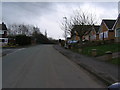
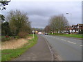
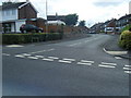
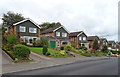
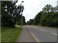
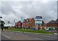
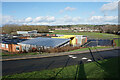
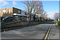
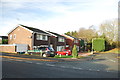
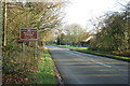
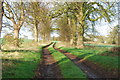
17 photos from this area
Area Information
Key information about the ST15 0AP including its size, population, and administrative classification.
- Area Type
- Postcode
- Area Size
- 1.0 hectares
- Population
- 1332
- Population Density
- 3732 people/km²
House Prices in ST15 0AP
21
Properties
£168,283
Average Sold Price
£57,000
Lowest Price
£247,000
Highest Price
Showing 21 properties
| Address | Type | Beds | Baths | Last Sale Price | Last Sale Date | |
|---|---|---|---|---|---|---|
| 17 Wood Lane, Stone, ST15 0AP | Detached | 3 | 1 | £247,000 | Jul 2024 | |
| 6 Wood Lane, Stone, ST15 0AP | house | - | - | £175,000 | Sep 2021 | |
| 38 Wood Lane, Stone, ST15 0AP | Semi-detached | 3 | 1 | £213,000 | Dec 2020 | |
| 28 Wood Lane, Stone, ST15 0AP | Bungalow | 2 | 1 | £185,000 | May 2018 | |
| 32 Wood Lane, Stone, ST15 0AP | Detached | 3 | 1 | £198,000 | Mar 2018 | |
| 20 Wood Lane, Stone, ST15 0AP | Bungalow | 2 | 1 | £162,000 | Oct 2014 | |
| 26 Wood Lane, Stone, ST15 0AP | Bungalow | - | - | £138,500 | Jan 2012 | |
| 34 Wood Lane, Stone, ST15 0AP | house | - | - | £185,000 | Sep 2010 | |
| 8 Wood Lane, Stone, ST15 0AP | Semi-detached | - | - | £136,000 | Sep 2008 | |
| 30 Wood Lane, Stone, ST15 0AP | Detached | - | - | £169,950 | Aug 2007 |
Page 1 of 3
Energy Efficiency in ST15 0AP
Amenities
Schools
| Rank | School | Type | Entry gender | Ages |
|---|
Explore more schools in this area
Go to Schools tabDemographics
Household Size
Two person
most common
Accommodation Type
Houses
most common
Tenure
90
majority
Ethnic Group
White
most common
Religion
N/A
most common
Household Composition
N/A
most common
Age
47
median
Adults (30-64 years)
most common
Household Deprivation
N/A
with no deprivation
NS-SEC
35
in Lower managerial occupations
Explore more demographic insights in this area
Go to Demographics tabPlanning
Planning Constraints
- Flood RiskPremium
- Ramsar Wetland SitesPremium
- Area of Outstanding Natural BeautyPremium
- Protected Nature ReservePremium
- Protected WoodlandPremium