Area Overview for ST14 5DL
Photos of ST14 5DL
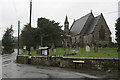

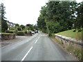
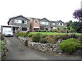
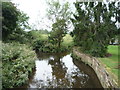
11 photos from this area
Area Information
Key information about the ST14 5DL including its size, population, and administrative classification.
- Area Type
- Postcode
- Area Size
- 22.3 hectares
- Population
- 1617
- Population Density
- 58 people/km²
House Prices in ST14 5DL
53
Properties
£242,220
Average Sold Price
£80,000
Lowest Price
£475,000
Highest Price
Showing 53 properties
| Address | Type | Beds | Baths | Last Sale Price | Last Sale Date | |
|---|---|---|---|---|---|---|
| 25 Vicarage Drive, Stramshall, ST14 5DL | Semi-detached | 4 | 1 | £295,000 | Jun 2025 | |
| 33 Vicarage Drive, Stramshall, ST14 5DL | Detached | 4 | 2 | £448,500 | Mar 2025 | |
| 32 Vicarage Drive, Stramshall, ST14 5DL | Semi-detached | 3 | 1 | £207,000 | Jul 2023 | |
| 35 Vicarage Drive, Stramshall, ST14 5DL | house | - | - | £435,000 | Apr 2023 | |
| 19 Vicarage Drive, Stramshall, ST14 5DL | Retail | 3 | 1 | £288,000 | Sep 2022 | |
| The Pastures, 41 Vicarage Drive, Stramshall, ST14 5DL | house | - | - | £475,000 | Feb 2022 | |
| 27 Vicarage Drive, Stramshall, ST14 5DL | Semi-detached | 3 | - | £255,500 | Oct 2021 | |
| The Farmhouse, Vicarage Drive, Stramshall, ST14 5DL | Detached | - | - | £80,000 | Jul 2020 | |
| Kentchurch, 2A Vicarage Drive, Stramshall, ST14 5DL | Bungalow | - | - | £220,000 | May 2019 | |
| The Vines, 51 Vicarage Drive, Stramshall, ST14 5DL | Detached | 6 | 1 | £390,000 | Mar 2019 |
Page 1 of 6
Energy Efficiency in ST14 5DL
Amenities
Schools
| Rank | School | Type | Entry gender | Ages |
|---|
Explore more schools in this area
Go to Schools tabDemographics
Household Size
Two person
most common
Accommodation Type
Houses
most common
Tenure
88
majority
Ethnic Group
White
most common
Religion
N/A
most common
Household Composition
N/A
most common
Age
47
median
Adults (30-64 years)
most common
Household Deprivation
N/A
with no deprivation
NS-SEC
38
in Lower managerial occupations
Explore more demographic insights in this area
Go to Demographics tabPlanning
Planning Constraints
- Flood RiskPremium
- Ramsar Wetland SitesPremium
- Area of Outstanding Natural BeautyPremium
- Protected Nature ReservePremium
- Protected WoodlandPremium