Area Overview for ST13 8RN
Photos of ST13 8RN
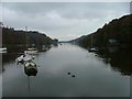
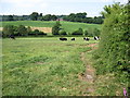
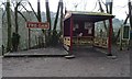
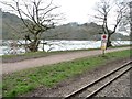
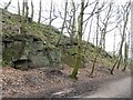
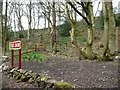
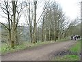
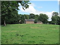
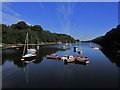

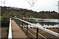
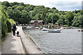
67 photos from this area
Area Information
Key information about the ST13 8RN including its size, population, and administrative classification.
- Area Type
- Postcode
- Area Size
- 15.6 hectares
- Population
- 1845
- Population Density
- 43 people/km²
House Prices in ST13 8RN
65
Properties
£301,349
Average Sold Price
£41,000
Lowest Price
£620,000
Highest Price
Showing 65 properties
| Address | Type | Beds | Baths | Last Sale Price | Last Sale Date | |
|---|---|---|---|---|---|---|
| Lindon Cottage, Lake Road, Rudyard, ST13 8RN | Detached | 3 | 1 | £355,000 | Sep 2023 | |
| Vine Cottage, Lake Road, Rudyard, ST13 8RN | Retail | 3 | 1 | £320,000 | Dec 2022 | |
| Bagheera, Lake Road, Rudyard, ST13 8RN | Semi-detached | 3 | 2 | £370,000 | Sep 2022 | |
| The Woodlands, Lake Road, Rudyard, ST13 8RN | Bungalow | 3 | 1 | £350,000 | Mar 2021 | |
| White Barn, The Drive, Rudyard, ST13 8RN | Bungalow | 3 | 2 | £360,000 | Nov 2020 | |
| Sylvian House, Lake Road, Rudyard, ST13 8RN | Detached | 3 | 1 | £415,000 | Sep 2019 | |
| Shaw Lodge, The Drive, Rudyard, ST13 8RN | Detached | 4 | 2 | £430,000 | Jul 2019 | |
| Well Spring Lodge, The Drive, Rudyard, ST13 8RN | Detached | 4 | 3 | £385,000 | Apr 2019 | |
| Nab Wood, Lake Road, Rudyard, ST13 8RN | Detached | 4 | 1 | £415,000 | Mar 2018 | |
| Winshaw Knoll, The Drive, Rudyard, ST13 8RN | house | 6 | - | £620,000 | Jan 2018 |
Page 1 of 7
Energy Efficiency in ST13 8RN
Amenities
Schools
| Rank | School | Type | Entry gender | Ages |
|---|
Explore more schools in this area
Go to Schools tabDemographics
Household Size
Two person
most common
Accommodation Type
Houses
most common
Tenure
88
majority
Ethnic Group
White
most common
Religion
N/A
most common
Household Composition
N/A
most common
Age
47
median
Adults (30-64 years)
most common
Household Deprivation
N/A
with no deprivation
NS-SEC
39
in Lower managerial occupations
Explore more demographic insights in this area
Go to Demographics tabPlanning
Planning Constraints
- Flood RiskPremium
- Ramsar Wetland SitesPremium
- Area of Outstanding Natural BeautyPremium
- Protected Nature ReservePremium
- Protected WoodlandPremium