Area Overview for ST13 8LU
Photos of ST13 8LU
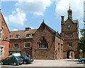
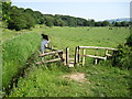
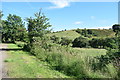
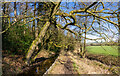
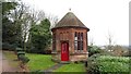
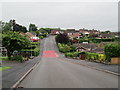
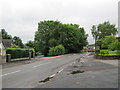
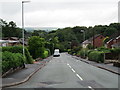
8 photos from this area
Area Information
Key information about the ST13 8LU including its size, population, and administrative classification.
- Area Type
- Postcode
- Area Size
- 28.5 hectares
- Population
- 1440
- Population Density
- 654 people/km²
House Prices in ST13 8LU
35
Properties
£173,889
Average Sold Price
£65,000
Lowest Price
£330,000
Highest Price
Showing 35 properties
| Address | Type | Beds | Baths | Last Sale Price | Last Sale Date | |
|---|---|---|---|---|---|---|
| 42 Westwood Park Avenue, Leek, ST13 8LU | Semi-detached | 3 | 1 | £330,000 | Apr 2023 | |
| Windrush, 32 Westwood Park Avenue, Leek, ST13 8LU | Detached | 3 | - | £270,000 | Apr 2022 | |
| 22A Westwood Park Avenue, Leek, ST13 8LU | Semi-detached | 3 | 1 | £180,000 | Jun 2020 | |
| 34 Westwood Park Avenue, Leek, ST13 8LU | Semi-detached | 3 | 2 | £234,950 | Jul 2018 | |
| 66 Westwood Park Avenue, Leek, ST13 8LU | Semi-detached | 3 | 1 | £184,000 | Dec 2015 | |
| 74 Westwood Park Avenue, Leek, ST13 8LU | Bungalow | 2 | - | £263,000 | Nov 2011 | |
| 46 Westwood Park Avenue, Leek, ST13 8LU | house | 3 | - | £165,000 | Sep 2011 | |
| 40 Westwood Park Avenue, Leek, ST13 8LU | house | 3 | - | £138,000 | Dec 2010 | |
| 48 Westwood Park Avenue, Leek, ST13 8LU | house | - | - | £205,000 | Jun 2005 | |
| 56 Westwood Park Avenue, Leek, ST13 8LU | Semi-detached | - | - | £160,000 | Sep 2004 |
Page 1 of 4
Energy Efficiency in ST13 8LU
Amenities
Schools
| Rank | School | Type | Entry gender | Ages |
|---|
Explore more schools in this area
Go to Schools tabDemographics
Household Size
Two person
most common
Accommodation Type
Houses
most common
Tenure
82
majority
Ethnic Group
White
most common
Religion
N/A
most common
Household Composition
N/A
most common
Age
47
median
Adults (30-64 years)
most common
Household Deprivation
N/A
with no deprivation
NS-SEC
33
in Lower managerial occupations
Explore more demographic insights in this area
Go to Demographics tabPlanning
Planning Constraints
- Flood RiskPremium
- Ramsar Wetland SitesPremium
- Area of Outstanding Natural BeautyPremium
- Protected Nature ReservePremium
- Protected WoodlandPremium