Area Overview for ST13 8JA
Photos of ST13 8JA
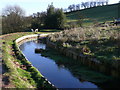
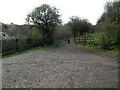
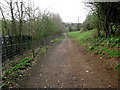
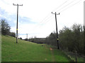

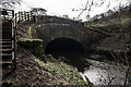
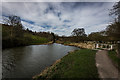
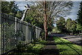
48 photos from this area
Area Information
Key information about the ST13 8JA including its size, population, and administrative classification.
- Area Type
- Postcode
- Area Size
- 1.9 hectares
- Population
- 1376
- Population Density
- 2492 people/km²
House Prices in ST13 8JA
31
Properties
£167,203
Average Sold Price
£52,750
Lowest Price
£315,000
Highest Price
Showing 31 properties
| Address | Type | Beds | Baths | Last Sale Price | Last Sale Date | |
|---|---|---|---|---|---|---|
| 45 Fernwood Drive, Leek, ST13 8JA | Detached | 3 | 1 | £220,000 | Feb 2025 | |
| 11 Fernwood Drive, Leek, ST13 8JA | house | - | - | £249,950 | Nov 2024 | |
| 7 Fernwood Drive, Leek, ST13 8JA | Detached | 4 | 1 | £315,000 | Aug 2022 | |
| 35 Fernwood Drive, Leek, ST13 8JA | Semi-detached | 3 | 1 | £200,000 | Jul 2020 | |
| 61 Fernwood Drive, Leek, ST13 8JA | Semi-detached | 3 | 1 | £180,000 | Jul 2020 | |
| 51 Fernwood Drive, Leek, ST13 8JA | Semi-detached | 3 | 1 | £200,000 | Sep 2019 | |
| 23 Fernwood Drive, Leek, ST13 8JA | Detached | 3 | 1 | £170,000 | Apr 2019 | |
| 63 Fernwood Drive, Leek, ST13 8JA | Semi-detached | 3 | 1 | £172,000 | Mar 2019 | |
| 9 Fernwood Drive, Leek, ST13 8JA | Detached | 4 | 2 | £279,950 | Oct 2018 | |
| 31 Fernwood Drive, Leek, ST13 8JA | Semi-detached | 3 | 2 | £182,000 | Jun 2018 |
Page 1 of 4
Energy Efficiency in ST13 8JA
Amenities
Schools
| Rank | School | Type | Entry gender | Ages |
|---|
Explore more schools in this area
Go to Schools tabDemographics
Household Size
Two person
most common
Accommodation Type
Houses
most common
Tenure
90
majority
Ethnic Group
White
most common
Religion
N/A
most common
Household Composition
N/A
most common
Age
47
median
Adults (30-64 years)
most common
Household Deprivation
N/A
with no deprivation
NS-SEC
36
in Lower managerial occupations
Explore more demographic insights in this area
Go to Demographics tabPlanning
Planning Constraints
- Flood RiskPremium
- Ramsar Wetland SitesPremium
- Area of Outstanding Natural BeautyPremium
- Protected Nature ReservePremium
- Protected WoodlandPremium