Area Overview for ST13 8EZ
Photos of ST13 8EZ
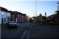
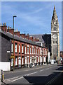
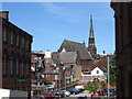
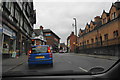
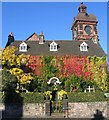
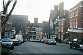
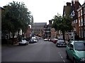
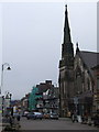
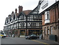
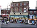

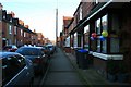
100 photos from this area
Area Information
Key information about the ST13 8EZ including its size, population, and administrative classification.
- Area Type
- Postcode
- Area Size
- 2.6 hectares
- Population
- 1115
- Population Density
- 400 people/km²
House Prices in ST13 8EZ
62
Properties
£112,728
Average Sold Price
£4,500
Lowest Price
£300,000
Highest Price
Showing 62 properties
| Address | Type | Beds | Baths | Last Sale Price | Last Sale Date | |
|---|---|---|---|---|---|---|
| 80 Hencroft, Leek, ST13 8EZ | Detached | 2 | 1 | £199,950 | Aug 2025 | |
| 51 Hencroft, Leek, ST13 8EZ | Terraced | 2 | 1 | £178,500 | Aug 2025 | |
| 62 Hencroft, Leek, ST13 8EZ | house | - | - | £140,000 | May 2025 | |
| Park Hills, 10 Hencroft, Leek, ST13 8EZ | Detached | 3 | 1 | £265,000 | Apr 2024 | |
| 53 Hencroft, Leek, ST13 8EZ | house | - | - | £165,000 | Jul 2023 | |
| 76 Hencroft, Leek, ST13 8EZ | Semi-detached | 2 | 1 | £180,000 | Mar 2023 | |
| 63 Hencroft, Leek, ST13 8EZ | Retail | 5 | 2 | £300,000 | Dec 2022 | |
| 35 Hencroft, Leek, ST13 8EZ | house | 2 | - | £137,500 | Jun 2021 | |
| 78 Hencroft, Leek, ST13 8EZ | house | 2 | - | £160,000 | Apr 2020 | |
| The Laurels, 2 Hencroft, Leek, ST13 8EZ | Detached | - | - | £4,500 | Aug 2017 |
Page 1 of 7
Energy Efficiency in ST13 8EZ
Amenities
Schools
| Rank | School | Type | Entry gender | Ages |
|---|
Explore more schools in this area
Go to Schools tabDemographics
Household Size
One person
most common
Accommodation Type
Houses
most common
Tenure
62
majority
Ethnic Group
White
most common
Religion
N/A
most common
Household Composition
N/A
most common
Age
47
median
Adults (30-64 years)
most common
Household Deprivation
N/A
with no deprivation
NS-SEC
30
in Lower managerial occupations
Explore more demographic insights in this area
Go to Demographics tabPlanning
Planning Constraints
- Flood RiskPremium
- Ramsar Wetland SitesPremium
- Area of Outstanding Natural BeautyPremium
- Protected Nature ReservePremium
- Protected WoodlandPremium