Area Overview for ST13 8EA
Photos of ST13 8EA
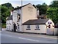
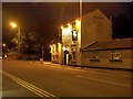
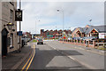
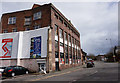
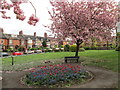
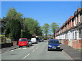
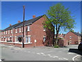
100 photos from this area
Area Information
Key information about the ST13 8EA including its size, population, and administrative classification.
- Area Type
- Postcode
- Area Size
- 2541 m²
- Population
- 1597
- Population Density
- 3078 people/km²
House Prices in ST13 8EA
25
Properties
£94,000
Average Sold Price
£19,500
Lowest Price
£140,500
Highest Price
Showing 25 properties
| Address | Type | Beds | Baths | Last Sale Price | Last Sale Date | |
|---|---|---|---|---|---|---|
| 22 Nunn Street, Leek, ST13 8EA | Terraced | 2 | 1 | £128,500 | Jan 2025 | |
| 36 Nunn Street, Leek, ST13 8EA | Terraced | 2 | 1 | £134,000 | Dec 2023 | |
| 40 Nunn Street, Leek, ST13 8EA | house | 2 | 1 | £115,000 | Mar 2021 | |
| 1 Nunn Street, Leek, ST13 8EA | Terraced | 4 | 1 | £140,500 | Feb 2019 | |
| 16 Nunn Street, Leek, ST13 8EA | Terraced | 2 | 1 | £84,000 | Jan 2018 | |
| 26 Nunn Street, Leek, ST13 8EA | Terraced | 2 | 1 | £104,000 | Dec 2016 | |
| 30 Nunn Street, Leek, ST13 8EA | Terraced | 2 | 1 | £90,000 | Sep 2015 | |
| 28 Nunn Street, Leek, ST13 8EA | Terraced | 3 | 1 | £116,000 | Jul 2014 | |
| 12 Nunn Street, Leek, ST13 8EA | Terraced | 2 | 1 | £71,000 | Apr 2014 | |
| 32 Nunn Street, Leek, ST13 8EA | house | - | - | £100,000 | Jul 2009 |
Page 1 of 3
Energy Efficiency in ST13 8EA
Amenities
Schools
| Rank | School | Type | Entry gender | Ages |
|---|
Explore more schools in this area
Go to Schools tabDemographics
Household Size
One person
most common
Accommodation Type
Houses
most common
Tenure
69
majority
Ethnic Group
White
most common
Religion
N/A
most common
Household Composition
N/A
most common
Age
47
median
Adults (30-64 years)
most common
Household Deprivation
N/A
with no deprivation
NS-SEC
32
in Lower managerial occupations
Explore more demographic insights in this area
Go to Demographics tabPlanning
Planning Constraints
- Flood RiskPremium
- Ramsar Wetland SitesPremium
- Area of Outstanding Natural BeautyPremium
- Protected Nature ReservePremium
- Protected WoodlandPremium