Area Overview for ST13 7TD
Photos of ST13 7TD
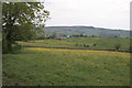
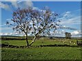
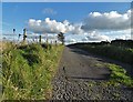
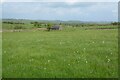
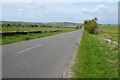

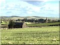
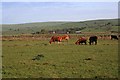

9 photos from this area
Area Information
Key information about the ST13 7TD including its size, population, and administrative classification.
- Area Type
- Postcode
- Area Size
- 78.1 hectares
- Population
- 1723
- Population Density
- 20 people/km²
House Prices in ST13 7TD
30
Properties
£472,941
Average Sold Price
£245,000
Lowest Price
£1,200,000
Highest Price
Showing 30 properties
| Address | Type | Beds | Baths | Last Sale Price | Last Sale Date | |
|---|---|---|---|---|---|---|
| Greenlow House, Butterton Moor Bank, Butterton, ST13 7TD | Retail | 4 | 2 | £700,000 | Aug 2022 | |
| Willow Farm, Butterton Moor Bank, Butterton, ST13 7TD | house | 3 | 3 | £1,200,000 | Jun 2022 | |
| Town End Farm, Lime Kiln Road, Butterton, ST13 7TD | Detached | 2 | 1 | £282,105 | Jul 2020 | |
| The Bollands, Butterton Moor Bank, Butterton, ST13 7TD | Detached | 4 | 1 | £525,000 | Dec 2018 | |
| Town End Cottage, Butterton Moor Bank, Butterton, ST13 7TD | Cottage | 3 | 1 | £400,000 | Nov 2018 | |
| Keys House, Lime Kiln Road, Butterton, ST13 7TD | Detached | 3 | - | £245,000 | Oct 2017 | |
| Rose Cottage, Lime Kiln Road, Butterton, ST13 7TD | Cottage | 3 | 1 | £390,000 | Feb 2017 | |
| Little Twist, Butterton Moor Bank, Butterton, ST13 7TD | Detached | 3 | 1 | £360,000 | Apr 2016 | |
| Turnock House, Lime Kiln Road, Butterton, ST13 7TD | Detached | 4 | 2 | £350,000 | Jan 2016 | |
| Greenlow Bank, Butterton Moor Bank, Butterton, ST13 7TD | house | 4 | - | £545,000 | Feb 2012 |
Page 1 of 3
Energy Efficiency in ST13 7TD
Amenities
Schools
| Rank | School | Type | Entry gender | Ages |
|---|
Explore more schools in this area
Go to Schools tabDemographics
Household Size
Two person
most common
Accommodation Type
Houses
most common
Tenure
76
majority
Ethnic Group
White
most common
Religion
N/A
most common
Household Composition
N/A
most common
Age
47
median
Adults (30-64 years)
most common
Household Deprivation
N/A
with no deprivation
NS-SEC
31
in Lower managerial occupations
Explore more demographic insights in this area
Go to Demographics tabPlanning
Planning Constraints
- Flood RiskPremium
- Ramsar Wetland SitesPremium
- Area of Outstanding Natural BeautyPremium
- Protected Nature ReservePremium
- Protected WoodlandPremium