Area Overview for ST13 7EE
Photos of ST13 7EE
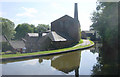
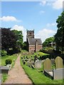
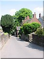


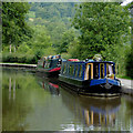
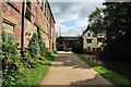

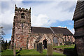

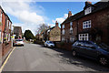
100 photos from this area
Area Information
Key information about the ST13 7EE including its size, population, and administrative classification.
- Area Type
- Postcode
- Area Size
- 34.9 hectares
- Population
- 2361
- Population Density
- 194 people/km²
House Prices in ST13 7EE
55
Properties
£245,923
Average Sold Price
£15,000
Lowest Price
£2,345,000
Highest Price
Showing 55 properties
| Address | Type | Beds | Baths | Last Sale Price | Last Sale Date | |
|---|---|---|---|---|---|---|
| 143 Station Road, Cheddleton, ST13 7EE | Terraced | 2 | 1 | £180,000 | Mar 2025 | |
| Hawthorne Cottages, 83 Station Road, Cheddleton, ST13 7EE | house | - | - | £115,000 | Jan 2025 | |
| 135 Station Road, Cheddleton, ST13 7EE | Terraced | 3 | 1 | £240,000 | Oct 2024 | |
| 187 Station Road, Cheddleton, ST13 7EE | Terraced | 2 | 1 | £225,000 | Sep 2024 | |
| 89 Station Road, Cheddleton, ST13 7EE | Terraced | 2 | 1 | £160,000 | Jun 2024 | |
| 133 Station Road, Cheddleton, ST13 7EE | Terraced | 2 | 1 | £182,500 | Jul 2023 | |
| 19 Station Road, Cheddleton, ST13 7EE | Terraced | 2 | 1 | £185,000 | Jun 2022 | |
| 193 Station Road, Cheddleton, ST13 7EE | house | - | - | £138,000 | Dec 2021 | |
| Lansdowne, Station Road, Cheddleton, ST13 7EE | Detached | 3 | 2 | £280,000 | Sep 2021 | |
| 149 Station Road, Cheddleton, ST13 7EE | house | 2 | 1 | £165,000 | Jul 2021 |
Page 1 of 6
Energy Efficiency in ST13 7EE
Amenities
Schools
| Rank | School | Type | Entry gender | Ages |
|---|
Explore more schools in this area
Go to Schools tabDemographics
Household Size
Two person
most common
Accommodation Type
Houses
most common
Tenure
85
majority
Ethnic Group
White
most common
Religion
N/A
most common
Household Composition
N/A
most common
Age
47
median
Adults (30-64 years)
most common
Household Deprivation
N/A
with no deprivation
NS-SEC
40
in Lower managerial occupations
Explore more demographic insights in this area
Go to Demographics tabPlanning
Planning Constraints
- Flood RiskPremium
- Ramsar Wetland SitesPremium
- Area of Outstanding Natural BeautyPremium
- Protected Nature ReservePremium
- Protected WoodlandPremium