Area Overview for ST13 6BB
Photos of ST13 6BB
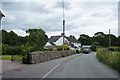
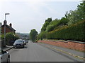
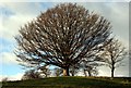
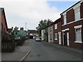
13 photos from this area
Area Information
Key information about the ST13 6BB including its size, population, and administrative classification.
- Area Type
- Postcode
- Area Size
- 1.9 hectares
- Population
- 1514
- Population Density
- 2284 people/km²
House Prices in ST13 6BB
24
Properties
£93,839
Average Sold Price
£44,000
Lowest Price
£215,000
Highest Price
Showing 24 properties
| Address | Type | Beds | Baths | Last Sale Price | Last Sale Date | |
|---|---|---|---|---|---|---|
| 12 Nelson Street, Leek, ST13 6BB | Terraced | 3 | 1 | £165,000 | Jul 2024 | |
| 26 Nelson Street, Leek, ST13 6BB | Semi-detached | 3 | 1 | £215,000 | Jan 2024 | |
| 9 Nelson Street, Leek, ST13 6BB | Terraced | 2 | 1 | £112,000 | Aug 2023 | |
| 11 Nelson Street, Leek, ST13 6BB | Terraced | 1 | 1 | £67,500 | Nov 2022 | |
| 18 Nelson Street, Leek, ST13 6BB | Terraced | 2 | 1 | £130,000 | Jul 2020 | |
| 22 Nelson Street, Leek, ST13 6BB | Terraced | 2 | 1 | £100,000 | Jul 2019 | |
| 7 Nelson Street, Leek, ST13 6BB | Terraced | 1 | 1 | £61,000 | Jun 2019 | |
| 25 Nelson Street, Leek, ST13 6BB | Terraced | 4 | 1 | £144,500 | Aug 2018 | |
| 4 Nelson Street, Leek, ST13 6BB | Terraced | 2 | 1 | £87,000 | Apr 2018 | |
| 3 Nelson Street, Leek, ST13 6BB | Terraced | 2 | 1 | £57,000 | Jun 2016 |
Page 1 of 3
Energy Efficiency in ST13 6BB
Amenities
Schools
| Rank | School | Type | Entry gender | Ages |
|---|
Explore more schools in this area
Go to Schools tabDemographics
Household Size
One person
most common
Accommodation Type
Houses
most common
Tenure
66
majority
Ethnic Group
White
most common
Religion
N/A
most common
Household Composition
N/A
most common
Age
47
median
Adults (30-64 years)
most common
Household Deprivation
N/A
with no deprivation
NS-SEC
21
in Lower managerial occupations
Explore more demographic insights in this area
Go to Demographics tabPlanning
Planning Constraints
- Flood RiskPremium
- Ramsar Wetland SitesPremium
- Area of Outstanding Natural BeautyPremium
- Protected Nature ReservePremium
- Protected WoodlandPremium